A Rich History The Sale of Rupertsland Simon J. Dawson: Surveyor, Civil Engineer, and Politician Anishinaabe Chief Showed Dawson the Way Lumber for the “Mother Church of Western Canada” Troubles at the Red River Colony: Surveying Gives Rise to Tensions Women in the ‘New West’ “Compagnie de la Graisse” Early Animal Shelter Eagle Bus Lines Métis Kinscape Métis Women Entrepreneurs Hauling for the C.P.R. on the Dawson Road Métis Carts Carry the Burden for the Wolseley Expedition First Reeve of Taché Signed his Name with an “X” The Legendary Midwinter Tramp of a Famous Lorette Resident Louis Riel Land Claim East of Lorette Rich Floras Leading to and past Pointe des chênes A Trip to Manitoba or “Roughing it on the Line” Canadian Pacific Railway Supersedes the Dawson Trail by 1885 The River Lot System Early Surveyors Meet with Resistance Last Survivor of the Old West: Alexandre Bériault Call To The Grey Nuns (Soeur Grises) A Long History of Health Services “A Most Beautiful Country” Mennonite Delegates in Sainte-Anne (1873) Bison Hunting Majestic Beaver Dam Of Mud and Straw Dawson Road Construction: Plagued with Troubles John Snow: Foreman of Road Building Workers Revolt: The “Dunking” of John Snow The Rise of Political and Social Turmoil The Governor-General’s Visit (1877) The Lost Treasure Corduroy Roads The Caribou Bog First Nations Employed on the Line (1868-1871) Working on the Dawson Road (1926-1928) A Naturally Abundant Landscape Forest Fire of 1897 Plight of a Luckless Traveler (1874) Harrison Creek: Gateway to Manitoba Birch River Station for Weary Travelers Manitoba Industrial Prison Farm Clean Water for Winnipeg East Braintree G.W.W.D. Worker Camp Scrip - ‘essentially the largest land swindle’ Red River Military Expeditions Dawson Route and Treaties No. 1 and No. 3 Chief Na-Sa-Kee-by-Ness and Road Negotiations Impact of the Homestead Act (1919)

The Park-like setting of the future Rural Municipality of Taché was very attractive to one and all. The land was arable and water was plentiful.

An Excerpt from a Winnipeg Free Press write-up on November 30, 1872 reads:

    “Reaching Winnipeg, we again turned out along the Dawson route, through a beautiful park-like country butting on the River Seine. In township 10, range 4, we found a dozen families from Ontario settled, who had taken claims previous to the location of the half-breed grant, which now covers this locality. The farms are well situated on the road, and will be very valuable, as they are within ten miles of town, and second to none in all the desiderate of food, water and fertility. (…) The road continues on to Pointe des Chênes in sight of the River Seine, through a most beautiful country, second to none anywhere in its material advantages.”


Source: Blom, R.R. (1980, April). Taché Rural Municipality 1880-1980 (P.7-8). Commissioned by The Council of the Rural Municipality of Taché. Derksen Printers, Steinbach: Manitoba. Retrieved from University of Manitoba digital collections June 3, 2020, http://hdl.handle.net/10719/3055598


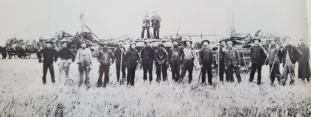
Harvesters came from the East on special trains to work the fields of the West. Barry Broadfoot, The Pioneer Years, 1895-1914. Print


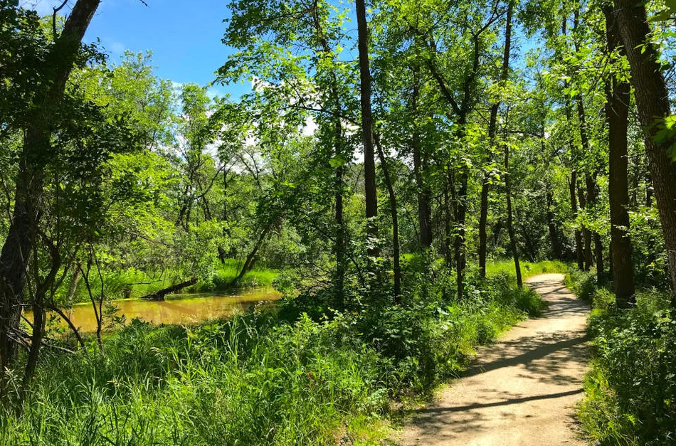
The Seine River Manitoba in the summer. The Dawson Trail followed the Seine River from Ste. Anne to Winnipeg. Save Our Seine. Retrieved from https://www.saveourseine.com/resources


Back to Old Finnegan Bridge / Old HBC Company Post Heritage Tour page | Top


Previous page: A Long History of Health Services
Next page: Mennonite Delegates in Sainte-Anne (1873)


© Copyright 2020 Dawson Trail Art & Heritage Committee. All Rights Reserved.
All images and materials used with permission of the copyright owners and may not be reused without their express permission.