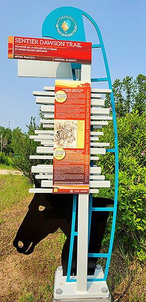
 Commemorative Marker #4
SEE GOOGLE MAP LOCATION 
From Lac Bossé retrace your route north to Dawson Road and turn right (east).
Continue approximately 8 kilometres east along Dawson Road (gravel).
The marker is located on the north side, along the Geppetto's Mini Golf property rear access from Dawson Road.
La Coulée St-Onge
La Coulée St-Onge is a tiny community east of Richer, within the Local Government District of Reynolds that carries the name of one of the pioneers of Richer (then Thibaultville). It is a lovely little stream that flows from the South of the great “Maskeg du Diable” (Devil’s Muskeg), crosses over the Dawson Road and continues North.
Today most people know this creek as Cripple Creek because of the Cripple Creek Campground on its sinuous path.
POINT OF INTEREST: La Coulée St-Onge
HISTORICAL NUGGETS: Forest Fire of 1897
“The Anishinabe (Saulteaux) peoples of this region made their livelihood on the making of moccasins, fabricating straw chairs, hunting, picking berries, fishing and trapping. Some of the French-Canadian families who settled in the area about 1895 include: Jean Baptiste Lemire, Augustin Vandal, Julien Hupé, Henri D’Hellencourt, Prosper Nault, Emile Mercier, Theodile Pattyn, Pierre Bosset, Jean Marie Godard, Porphyre Harrison, and Joseph Renaud. In 1896, others came, among them: Maxine Champagne, Pierre Champagne, Isidore Hupé, Pierre Sabot and Edward Harrison.
"Most of these settlers made a living cutting wood in winter, hunting, fishing, picking blueberries or digging Seneca root along the Whitemouth River. The early store was operated by Fernand Vieville who years later sold it to Archie Thurston. Pierre Poitras operated the first sawmill and was followed by Fred Acres, Honore Therrien and Charles Saindon, who a few years later each operated their own along Dawson Road. People from Ste. Anne, Lorette, Steinbach and Ile des Chênes bought their lumber at these saw mills.”
Hadashville Women's Institute
Sources:
Hadashville Women's Institute. (1970). A Packsack of Seven Decades (p. 100). Derksen Printers. Retrieved from the digital collections of the University of Manitoba June 3, 2020 http://hdl.handle.net/10719/3066498
Barkwell, L. (2016, November 8). Fort Garry Band (Upper Fort Garry): The forgotten history of the Saulteaux-Metis Band at the forks of the Red and Assiniboine Rivers (P.5). Retrieved March 2020 from https://www.scribd.com/document/330441089/Fort-Garry-Band-Upper-Fort-Garry
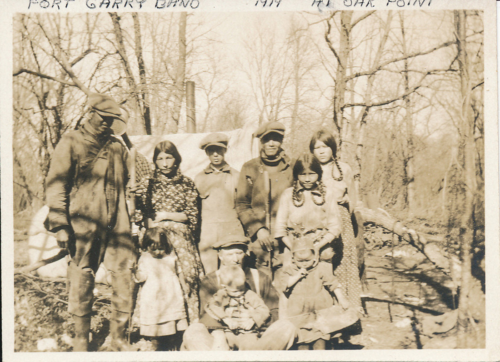
“Fort Garry Band” Saulteaux First Nation family on the trapline near “Oak Point” settlement in 1914 which is now Ste. Anne, Manitoba. According to Lawrence Barkwell, “This band appears in the report of the Indian Affairs branch of the department of the secretary of state for the provinces in 1872 as having been paid at the Stone Fort [Lower Fort Garry] on Aug 4 and 5th 1871. Because of the embarrassment their claim to the city of Winnipeg lands outside the Selkirk survey and their reservation within that survey were to Canadians like [Dr. Charles Schultz] who was the largest land owner in Winnipeg, they were scattered among other bands by the Canadian government. Today they are ignored at places like “The Forks” which was the camping ground by which they took their name, for the same reason.” They eventually were given the option to choose where their Reserve would be and they selected Brokenhead, though some families went to Fort Alexander (Sagkeeng First Nation) as part of Treaty 1 signed in 1871. Source: Barkwell, L. (2016, November 8). Fort Garry Band (Upper Fort Garry): The forgotten history of the Saulteaux-Metis Band at the forks of the Red and Assiniboine Rivers (P.5). Retrieved March 2020 from https://www.scribd.com/document/330441089/Fort-Garry-Band-Upper-Fort-Garry
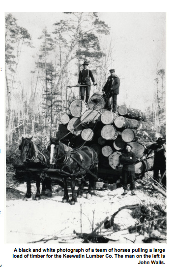
Photo of the local lumber industry in Lake of the Woods area (unknown date). Forestry History Society of Ontario. Forestory, Volume 10, Issue 1, Spring 2019. Retrieved from The Agreement Forest Program, Caterpillar Tractors, Wild Turkeys and Much, Much, More
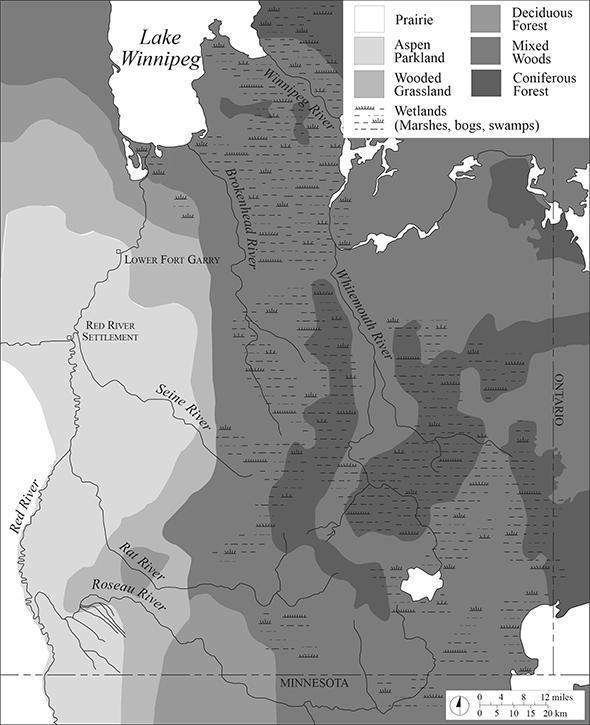
Vegetation map of southeastern Manitoba at the time of the Red River Settlement showing the receding of the forested areas with successive fires and logging activities. Photo of the local timber industry in Lake of the Woods area (unknown date). Source: Forestry History Society of Ontario. Forestory, Volume 10, Issue 1, Spring 2019. Retrieved from The Agreement Forest Program, Caterpillar Tractors, Wild Turkeys and Much, Much, More See also Adaptation from: Shay, T. (2015). Pioneers on the Forest Fringe: The Wood Economy of Red River Settlement, 1812-1883. Manitoba History. Number 78, Summer 2015. Welton, East Yorkshire, England. Image: Weir, T.R. ( ). Economic Atlas of Manitoba (P. 21 or P. 29). J. Warkentin and R. I. Ruggles. Retrieved June 29, 2020 from http://www.mhs.mb.ca/docs/mb_history/78/woodeconomy.shtml
Go to Next Tour Location: Brokenhead River Crossing | Top
Previous page: Lac Bossé
Next page: Brokenhead River Crossing