"In the late 1960s, Canada and Manitoba undertook many projects in preparation for their centennial anniversaries, including the reconstruction of part of Dawson Road. In 1971 two signs along Lagimodiere Boulevard in Winnipeg were erected by the Metropolitan Corporation of Greater Winnipeg to commemorate Dawson Road, a project of the Canadian government that started in 1868. Named for Simon James Dawson, the route preceded the railway expansion into the West, running from a trailhead at the NorthWest Angle to the City of St. Boniface, and for years was a major transportation route into western Canada. The route remains as portions of present-day Speers Road, Lagimodiere Boulevard, Dawson Road North, and Dawson Road South."
Gordon Goldsborough for Manitoba Historical Society
Source: Goldsborough, G. (1998-2020). Historic Sites of Manitoba: Dawson Road Signs (Lagimodière Boulevard, Winnipeg). Manitoba Historical Society. Retrieved June 4, 2020 from http://www.mhs.mb.ca/docs/sites/dawsonroad2.shtml
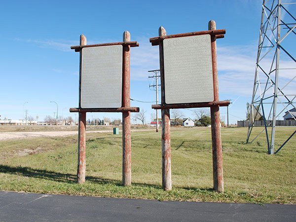
Two weathered signs commemorating the Dawson Trail, erected for centennial celebrations in 1970-71, still stand at Lagimodière Boulevard in Winnipeg. Photo credit Gordon Goldsborough, Manitoba Historical Society. Retrieved June 4, 2020 from http://www.mhs.mb.ca/docs/sites/dawsonroad2.shtml
Sign Text: Construction of the historic Dawson Road was undertaken by the federal government in 1868, before the West joined Canadian Confederation. Starting in St. Boniface, this Canadian road heads east, crossing 91 miles of farmland, swamps and forests to reach the northwestern limit of Lake of the Woods, then east again through hundreds of miles of lakes, rapids and rocky portages. This route has been travelled by prominent emigrants such as Governor A.G. Archibald, Engineer S.J. Dawson, Colonel G.J. Wolseley and his troops, and thousands of immigrants before the railway arrived in 1878. Since then, this legendary route has been used only by local residents. Erected by the Metropolitan Corporation of Greater Winnipeg, 1871.
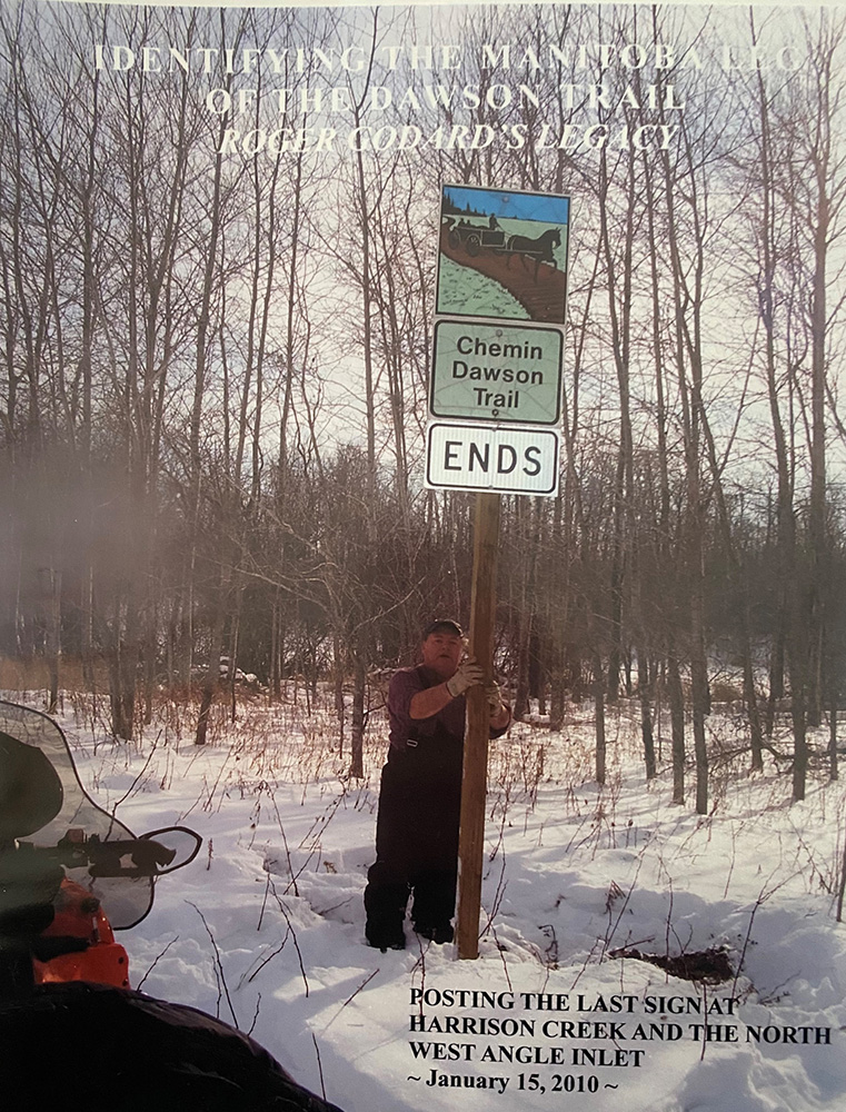
The Dawson Trail was designated an historical route by the Province of Manitoba in April 1995. Roger Godard, a local resident of Richer posting the last road sign at Harrison Creek and the NorthWest Angle Inlet (2010). Photo credit: Roger Godard
Next: Link Between Manitoba and Ontario | Top
Previous page: Dawson Road in Saint Boniface
Next page: Link Between Manitoba and Ontario