A Rich History The Sale of Rupertsland Simon J. Dawson: Surveyor, Civil Engineer, and Politician Anishinaabe Chief Showed Dawson the Way Lumber for the “Mother Church of Western Canada” Troubles at the Red River Colony: Surveying Gives Rise to Tensions Women in the ‘New West’ “Compagnie de la Graisse” Early Animal Shelter Eagle Bus Lines Métis Kinscape Métis Women Entrepreneurs Hauling for the C.P.R. on the Dawson Road Métis Carts Carry the Burden for the Wolseley Expedition First Reeve of Taché Signed his Name with an “X” The Legendary Midwinter Tramp of a Famous Lorette Resident Louis Riel Land Claim East of Lorette Rich Floras Leading to and past Pointe des chênes A Trip to Manitoba or “Roughing it on the Line” Canadian Pacific Railway Supersedes the Dawson Trail by 1885 The River Lot System Early Surveyors Meet with Resistance Last Survivor of the Old West: Alexandre Bériault Call To The Grey Nuns (Soeur Grises) A Long History of Health Services “A Most Beautiful Country” Mennonite Delegates in Sainte-Anne (1873) Bison Hunting Majestic Beaver Dam Of Mud and Straw Dawson Road Construction: Plagued with Troubles John Snow: Foreman of Road Building Workers Revolt: The “Dunking” of John Snow The Rise of Political and Social Turmoil The Governor-General’s Visit (1877) The Lost Treasure Corduroy Roads The Caribou Bog First Nations Employed on the Line (1868-1871) Working on the Dawson Road (1926-1928) A Naturally Abundant Landscape Forest Fire of 1897 Plight of a Luckless Traveler (1874) Harrison Creek: Gateway to Manitoba Birch River Station for Weary Travelers Manitoba Industrial Prison Farm Clean Water for Winnipeg East Braintree G.W.W.D. Worker Camp Scrip - ‘essentially the largest land swindle’ Red River Military Expeditions Dawson Route and Treaties No. 1 and No. 3 Chief Na-Sa-Kee-by-Ness and Road Negotiations Impact of the Homestead Act (1919)

    “At the northern peak of the Angle, leading northwest from Harrison Creek, runs the old Dawson Road …The old turnpike is well defined for almost 9 miles. Before the railroad was built it was the only thoroughfare into the Canadian Northwest and was traversed by several hundred Red River ox carts.

    "Two miles across open water from the Point on the Angle mainland is the Feldspar mine, operated until 1934, when a low-water stage hindered barge movements and forced its abandonment. The Angle feldspar dike is one of the largest in North America, with an estimated possible volume of 16,000 to 18,000 tons. In bright sunlight the feldspar, strewn with fragments of dynamite rock, glows like fire.”

    "Near the Angle is the Site of Fort St. Charles on the southern shore established by French explorer LaVérendrye. It was here in 1736 that 21 Frenchmen, among them Jean-Baptiste, eldest son of the Sieur de la Vérendrye, and Father Aulneau were attacked by Dakota. They are buried on the site of the old fort."

WPA Guide to Minnesota


Source: Federal Writer’s Project. (2013, Oct 31). The WPA Guide to Minnesota: The North Star State. Trinity Western. Retrieved July 2, 2020 from https://books.google.ca/books?id=lmHpCAAAQBAJ...


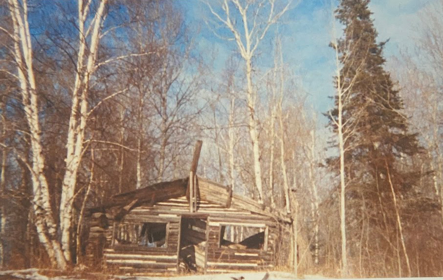
(Below upper) What remained of the old forestry cabin in 1993 at Harrison Creek near the NW Angle. There are no buildings standing today. Credit: Roger Godard.


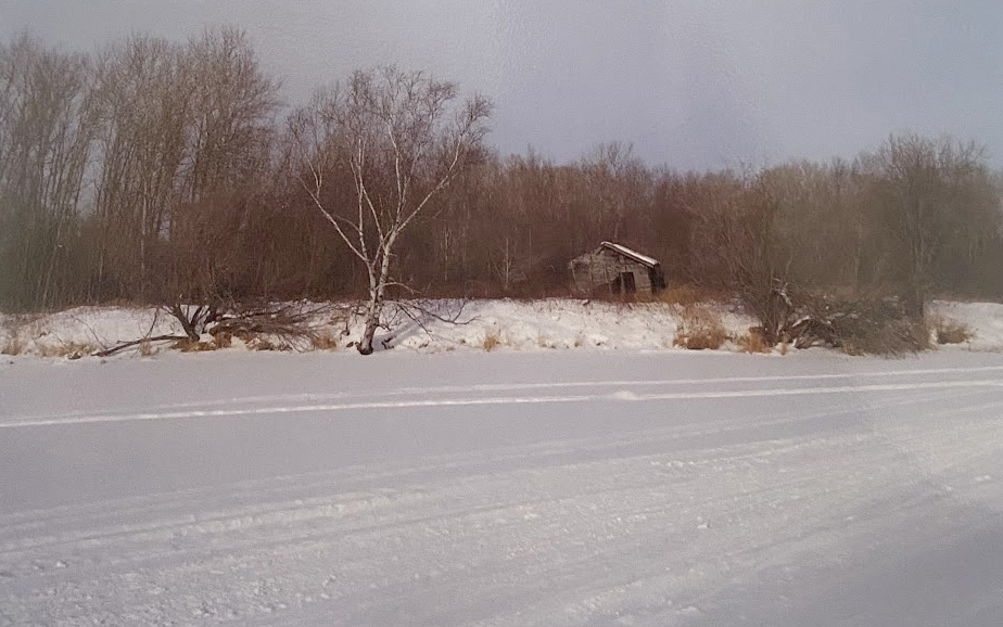
(Above lower) Last vestige of the village at the NorthWest Angle (2010, Jan 15). Photo credit: Roger Godard.


Back to NorthWest Angle - Lake of the Woods Heritage Tour Page | Top


Previous page: Plight of a Luckless Traveler (1874)
Next page: Birch River Station for Weary Travelers


© Copyright 2020 Dawson Trail Art & Heritage Committee. All Rights Reserved.
All images and materials used with permission of the copyright owners and may not be reused without their express permission.