POINT OF INTEREST:
Harrison Creek Marker - NorthWest Angle - Lake of the Woods
HISTORICAL NUGGETS:
Harrison Creek: Gateway to Manitoba
NorthWest Angle - Lake of the Woods:
Marker #1 Harrison Creek
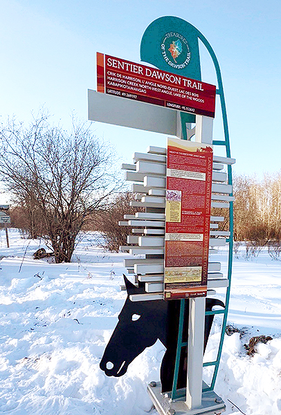
Remote location - Winter Access ONLY
This marker is only accessible by snowmobiling across a winter road so it is not included in our standard heritage tour.
“Today, the historic Dawson Trail from the NorthWest Angle to Winnipeg is a mere shadow of its earlier years. At the western end, starting at the corner of Plinguet Street in St. Boniface, the trail winds its way in broken stretches through the new suburbs of South Saint Boniface, the Villages of Lorette, Dufresne, Sainte-Anne and Richer. Further East, it becomes haphazard gravel road and woodland trails, cut off at the Whitemouth River, and eventually reaching the north-south highway #308 to Sprague, just south of East Braintree. From the 308, the last 25-kilometer portion to the NorthWest Angle is a barely visible wood trail, whose swamps are impassable in summer and is partly used in winter as a portion of the Pan-Am snowmobile trail system. At the end of the trail, on Harrison Creek, you can still find the remains of the village that used to serve as a way station and rest area for the thousands of immigrants who had the courage to travel the Dawson Road to reach the land of their dreams.
"History has forgotten Dawson and his accomplishments. Yet in terms of historical significance, the Dawson Route was as important to our country as the Oregon Trail was to our neighbors in the U.S. It was the link that joined East and West to form this wonderful country of ours. It is the road that brought many of our ancestors here.”
Roger Dupas, local resident and author, circa 1990s
Source: Dupas, R. (date unknown due to loss of archival records, circa late 1900s). Tale of Dawson Trail…Too Long Forgotten. Dawson Dispatch newspaper. Retrieved from the personal research collection of Norm Lavack, local resident.
“When the British government agreed, in 1871, to set up a joint commission with the American government to mark the International Boundary from the northwestern point of the Lake of the Woods to the summit of the Rocky Mountains, it was aware “that the meridian due south from that point seemed to cut of a piece of land, leaving it in United States Territory.” The report of Col. J.S. Hawkins, head of the British Commission that had earlier marked the western boundary, added, “This land should be retained for Canada if possible”…
"In accordance with his orders, Cameron would not agree to the authenticity of the old monument but he did consent to have a sight line cut from the Angle due south. The line established the fact that the landing stage for the boats running on the Lake of the Woods, the Hudson’s Bay post, and half a mile of the Dawson Road lay within the boundary of the United States. This was the road (largely lakes, river and portages) surveyed in 1857 by Simon J. Dawson and later used as a Canadian route from Port Arthur (Lake Superior) to Winnipeg. This boundary problem was responsible for keeping various groups of the British Commission working at the Angle and vicinity throughout their years in Canada.
"The first work to be done was to survey and mark the boundary from the Angle to the 49th parallel, and west to the Red River. This was accomplished during the winter of ’72-’73, and proved to be a very arduous task. The second necessity was to find a suitable location for a new landing stage on the lake and a terminus for the Dawson Road on Canadian soil. This had to include a short road to connect with the old road. Every stream and ridge in the vicinity was thoroughly traversed. A poplar ridge was found north of the old landing which could be used by means of building a short road north, then west, and then south to join the original road.”
Marjorie Forrester, The Beaver magazine, autumn 1960
Source: Forrester, M. (1960). “That NorthWest Angle”. The Beaver, Autumn 1960, (P.32-24). Canada’s History Archive featuring The Beaver. Retrieved July 9, 2020 from https://canadashistory.partica.online/canadas-history/the-beaver-autumn-1960/flipbook/1/
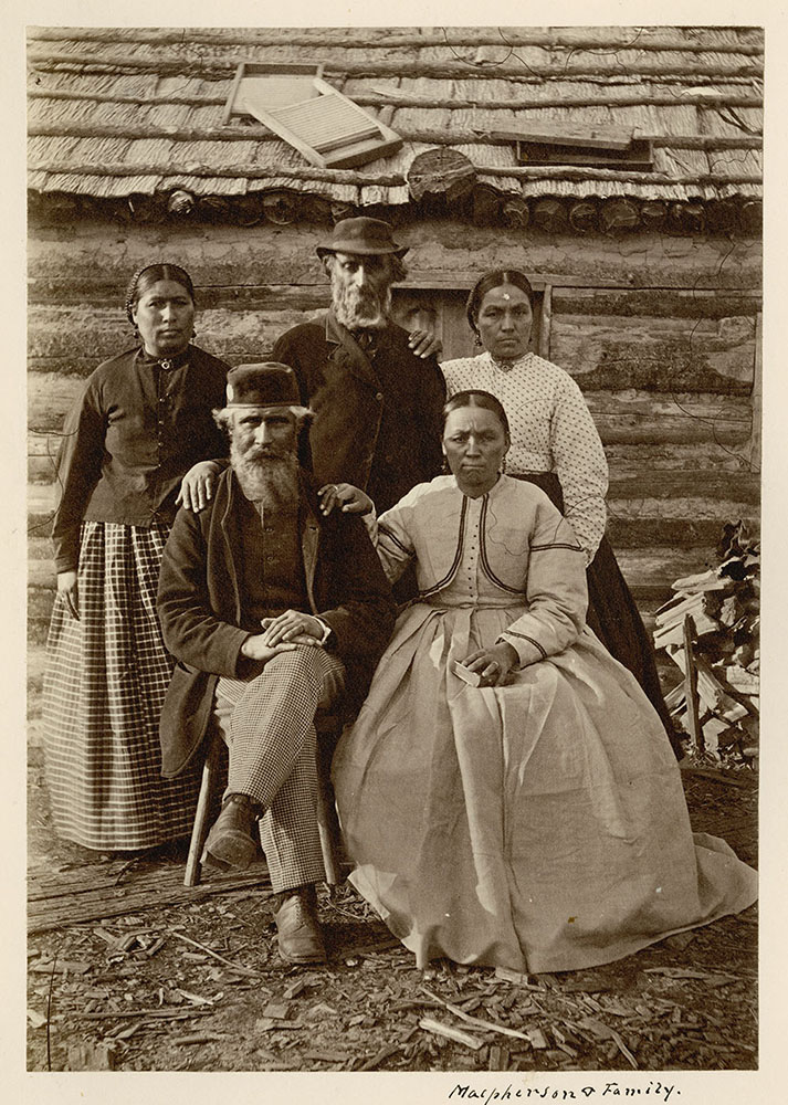
Trader George McPherson and his family welcomed travelers arriving at the NW Angle, Lake of the Woods, Ontario, October 1872. George McPherson and his family, Northwest Angle, Lake of the Woods (present-day Ontario), Source: Library and Archives Canada/George M. Dawson fonds/e011156525
“The NorthWest Angle of the Lake of the Woods is where the land portion of the Dawson Route begins after 600 miles of water. It's only land link is the Angle’s western border with Manitoba, though with the old Dawson Trail grown over so many years later, it is difficult if not impossible to get to even in perfect weather conditions. To the north and east is the border with Ontario and to the south, the boundary waters with the USA. On a map, the Northwest Angle doesn't make much sense because it should logically be at the 49th parallel, but it was pushed a bit further north owing its existence to surveying errors made in the early and awkward days of forming a border between the USA and British territory. It came about due to their overreliance on a map that misidentified the source of the Mississippi River and the shape of Lake of the Woods when drawing up borders in the late 1700s. It was determined the border between the U.S. and British holdings would run from the northwest corner of Lake of the Woods west to the Mississippi River — which was in fact south, not west. Then in the early 19th century, an attempt was made to correct the mistake with a decision the border would run due south from the northwest corner of Lake of the Woods creating an odd little piece of the USA that juts into what is otherwise Canada all around it. During the height of Dawson Road in the 1870s, the NorthWest Angle was the landing and first welcome for travellers arriving either by canoe or by steamer to the gateway of the west after a very long journey. It was not much of a sight, but travelers were generally happy to see it, relieved the water part of their long journey was behind them and getting a chance to eat and rest, many nearly starving on their journey west. That is, of course, until they got on the road!”
Mireille Lamontagne, Dawson Trail Arts & Heritage Tour researcher
Source: Lamontagne, M. (2020). Historiography of the Dawson Trail. Dawson Trail Arts & Heritage Tour.
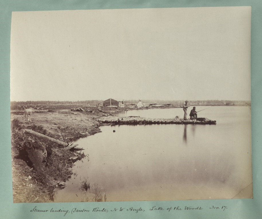
Harrison Creek at the North-West Angle, the steamer landing for Dawson Road (1876). Image shows George McPherson fishing from his dock, circa 1878. McPherson was the HBC officer in charge at Northwest Angle at the time of Treaty 3. One George McPherson Sr. is named as a witness on the Treaty 3 document. McPherson was appointed Indian Agent on the Lake of the Woods in 1877. Source: National Archives UK. LAC CO 1069-272-14. Retrieved from https://www.flickr.com/photos/nationalarchives/7457056186/in/photostream/
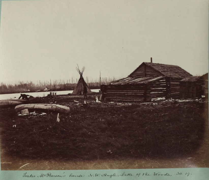
Trader McPherson’s house at the NorthWest Angle, No.19. National Archives UK. Retrieved from https://www.flickr.com/photos/nationalarchives/7457056908/in/photostream/
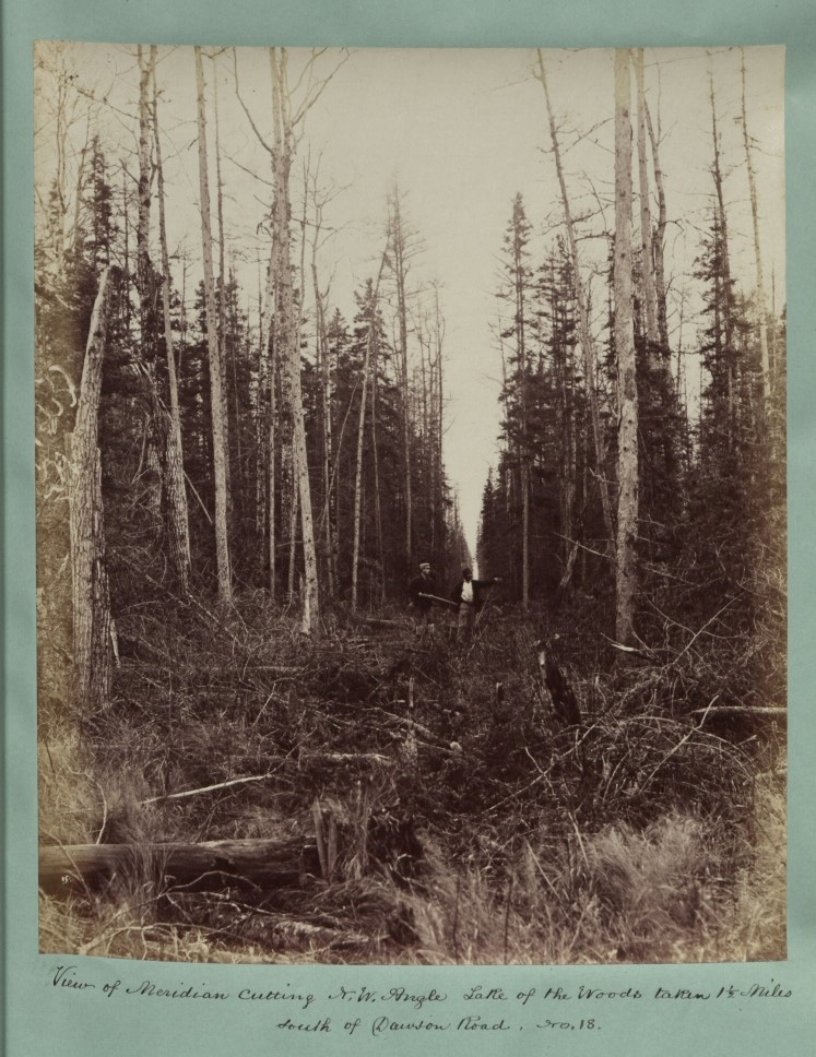
View of meridian cutting, N.W. Angle Lake of the Woods, taken 1 ½ miles south of Dawson Road. No. 15 (1876). National Archives UK. Colonial Office Photographic Collection. LAC CO 1069-272-15. Retrieved from https://www.flickr.com/photos/nationalarchives/7457058184/in/photostream/
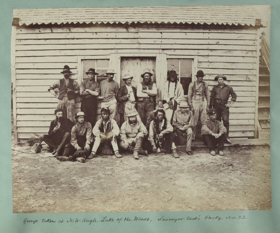
Survey party of the International Boundary Commission at the NorthWest Angle of the Lake of the Woods, circa 1876, party No 23. National Archives UK. Colonial Office photographic collection. LAC CO 1069-272-20. Retrieved from https://www.flickr.com/photos/nationalarchives/7457060726/in/photostream/
Go to Next Tour Location: Ross Church Bell Monument | Top
Previous page: East Braintree
Next page: Ross Church Bell Monument