HISTORICAL NUGGETS:
Dawson Road Construction: Plagued with Troubles
The Rise of Political and Social Turmoil
Commemorative Marker #6 & Permanent Exhibits:
Millstone Display / Triptych Painting
Click for Google Map location
Theme: Côteau Pelé / Dunking of Snow
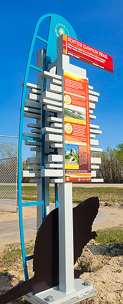
On the eastern corner of Thurston Drive and the Dawson Road is Thurston Drive Park, home to Marker #6 and two permanent exhibits.
This general area, now referred to as La Coulée, was home to First Nations camps and trails since time immemorial.
There were many silty ridges known as côteaux in the Michif language, that ran north-west to south-east throughout southern Manitoba.
These were remnants of Lake Agassiz beaches formed 10,000-3,000 years ago.
It is also home to key highlights relevant to the construction of the Dawson Trail, commemorated here through Marker #6 and two permanent artistic exhibits, including a triptych mural of the people, places and events that marked the chapters of this history, and landscaping with millstones originating from the local village.
Millstone Exhibit
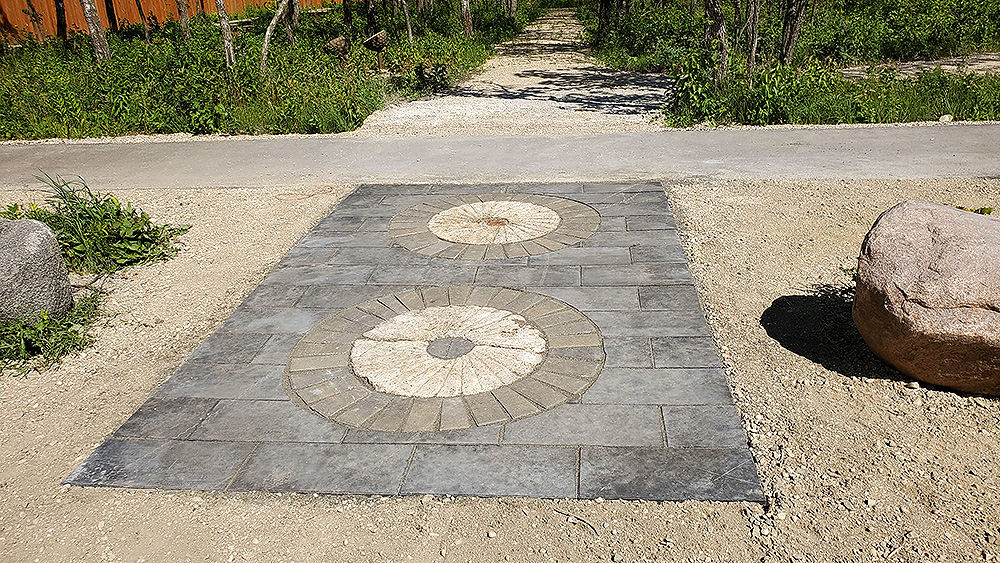
These two original millstones were pulled from the Seine river near river lot #11, South of the Dawson Road around Sainte-Anne (once owned by M. Philippe Lebrun). The millstones at the entrance of the Park were found in the 1960s, northeast of the Lebrun bridge. Special thanks to the local Chaput family for their donation of the stones. Landscaping by Troy Barkman of Paradise Landscape and Design.
Exhibit Mural - Triptych
(A triptych is a work of art that is divided into three sections)
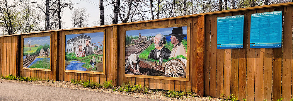
The mural highlights key people, events, and places relevant to the Dawson Trail construction headquarters established in this area in 1868. The road emerged in 1871 as a gateway for Canada from the East to the West in preparation for the coming railway, and to forestall the threat of annexation by Americans. The mural was painted by artist David Carty.
Relax and have a walk around, then continue east on Dawson Road #207.
Go to Next Tour Location: Corduroy Road Exhibit | Top
Previous page: Côteau Pelé, aka Harrison’s Ridge
Next page: Corduroy Road Exhibit