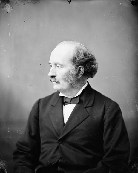
Dawson, Simon, James M.P. (Algoma, Ont.) 1818 - 1902. Engineer of the Dawson Trail which served as an essential link between eastern and western Canada. Source: Library and Archives Canada/Topley Studio fonds/a033901, Bibliothèque et Archives Canada/MIKAN 3415583. Retrieved from DAWSON, SIMON JAMES – Volume XIII (1901-1910) – Dictionnaire biographique du Canada
“Simon Dawson (1818-1902), is recognized for surveying in the Hind Expedition of 1857-58 (with Henry Youle Hind). This led to his work in proposing, designing and construction of the Dawson Road in 1868-71 as the most navigable route between what are now Ontario and Manitoba in preparation for the railway to come through. His years of service with French Canadian work-crews and Indigenous boatmen gave rise to an understanding that he was to express later in regions far removed from Lower Canada. It seems likely that his early government appointments were secured through the influence of his brother William McDonell Dawson, superintendent of the woods and forests branch of the Crown Lands Department and later a member of the Legislative Assembly, who was closely tied to the Toronto business group then urging westward expansion.
"In his later political career, he advocated for the creation of provincial status for that area of Ontatrio from French River to Lake of the Woods. Dawson was well-regarded among Métis, First Nations and French-Canadians for his support for bilingualism for the North-West Territories, for Indigenous fishing rights, and for Aboriginal rights generally.
"In the early 1870’s, Dawson gained national recognition when he became involved in treaty negotiations concerning the Saulteaux lands in Lake of the Woods. It was his knowledge of the region and his building expertise that brought Dawson fleeting notoriety. He soon became disillusioned with the decisions made by distant governments. He was shocked at the effect government policy was having in the area.”
Historian Elizabeth Arthur in her biography of Simon J. Dawson, 1994
Source: Arthur, E. (1994). DAWSON, SIMON JAMES. Canadian Dictionary of Biography, vol 13. University of Toronto/Université Laval. Retrieved June 10, 2020, http://www.biographi.ca/en/bio/dawson_simon_james_13F.html
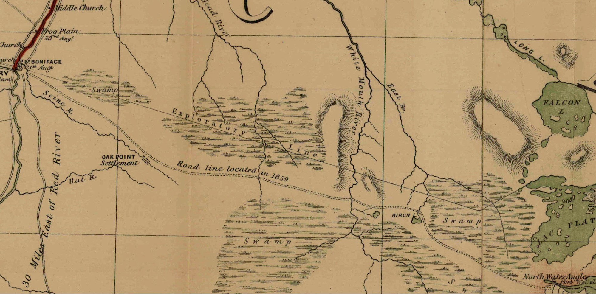
Dawson Road portion of the Shewing Line of Route between Lake Superior and Red River Settlement by Simon J. Dawson, as lithographed and printed by Captain C.W. Wilson of the Department of War Office, 1870. The date, as noted on the map itself, refers to the arrival of the first Detachment of the Expeditionary Force led by Wolseley which Dawson accompanied. Retrieved from https://www.flickr.com/photos/manitobamaps/2089382823
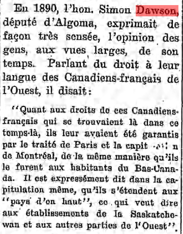
English translation: In 1890, the Honourable Simon Dawson, Member of Parliament for Algoma, expressed the views of the broad-minded people of his day in a very sensible way. Speaking of the right to their language as French Canadians in the West, he said: "As for the rights of those French Canadians who were there at that time, they had been guaranteed to them by the Treaty of Paris and the surrender of Montreal, just as they had been guaranteed to the people of Lower Canada. It is expressly stated in the capitulation itself, that they extend to the "pays d’en haut,” which means all the way to the settlements of Saskatchewan and other parts of the West.” Source: Libre Parole, Winnipeg, Manitoba, CA, May 4, 1916 (P. 4), “Simon Dawson parlant du droit à leur langue". Retrieved June 9, 2020 from http://hdl.handle.net/10719/2672945
Back to St. Boniface Heritage Tour page | Top
Previous page: The Sale of Rupertsland
Next page: Anishinaabe Chief Showed Dawson the Way