SEE GOOGLE MAP LOCATION 
POINT OF INTEREST: La Coulèe des Ressources
Coulée “des sources” or “des ressources”?
Tuyau | La Coulee School
HISTORICAL NUGGETS:
John Snow: Foreman of Road Building
Workers Revolt: The “Dunking” of John Snow
Continue driving east on Dawson Road #207 past the La Coulee sign. In about 2 kilometers you will see the stream on the south side. If you want to see it up close you can turn south on Proulx Road and see it at the bottom of the hill.
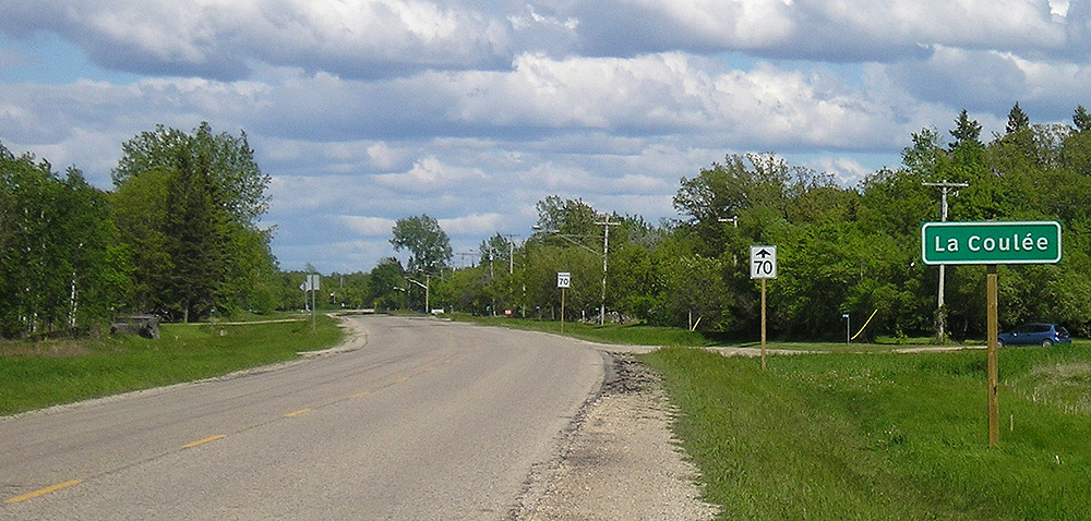 La Coulèe des Ressources
(La Coulée des Sources, aka La Coulée des ressources, Rebel Coulée)
La Coulée des Sources, also referred to by some as “La Coulée des ressources” or “Rebel Coulée”, is the original name given to the spring fed stream that runs along the south side of the Dawson Road for a distance. It begins east of Lake Riviera and runs into the Seine River. An Anishinabe (Saulteaux) village was situated at this fork. It was the custom of First Nations living in the swamplands of southern Manitoba to travel along the high gravel ridges between encampments. They also buried their loved ones on the ridges away from the water. Somewhere between le Côteau Pelé and La Coulée des Sources (later shortened to La Coulée) is a First Nations cemetery. (North side of Dawson Road).
At the edge of the forest (four kms east from the Ste. Anne town office), Jean-Baptiste Desautels had a farm and a sawmill near La Coulée on River lot #70. It was at this place that the builders began work on the Dawson Road under the direction of John Snow.
Wikipedia, La Coulée, Manitoba La Coulée, Manitoba 2020. Photo from Wikipedia, La Coulée, Manitoba La Coulée, Manitoba
 |
 |
 |
|
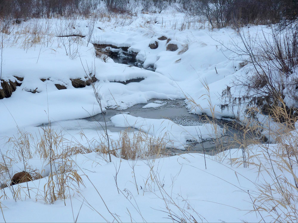
Wintertime in La Coulée “des Sources” or “des Ressources” (2020, Dec) Photo credit: Mireille Lamontagne |
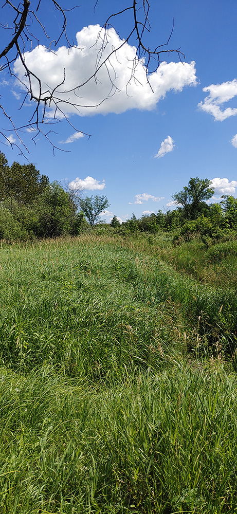
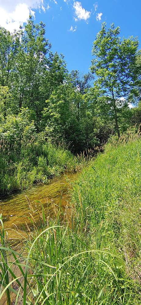
Summer views of the stream in La Coulee.
|
||
Coulée “des sources” or “des ressources”?
While the region of La Coulée was originally referred to as La Coulée des Sources because of the spring-fed creek that runs through it, some locals took to calling it La Coulée des Ressources (the Coulee of Resources). By the early 1800s, the Métis and some Canadiens of the Red River Colony had established roles as buffalo hunters and provisioners to the North West Company. They nurtured an enterprising and entrepreneurial spirit in the Red River Colony. Coupled with the abundance of resources in the area (i.e. land, gravel, lumber and peat) this “source of resources” would fuel many thriving businesses within these sectors for years to come.
“The main influx of French-Canadian settlers came to Oak Pointe (Ste. Anne) in 1856. One of the more enterprising of these, Mr. Jean-Baptiste Desautels dit Lapointe, built a sawmill on a site near the Seine River about three miles east of Oak Point in La Coulée-des-Sources . In order to get more land Mr. Desautels approached the Saulteaux ... Chief, Long Ears (Grandes Oreilles), and paid for it with a few bags of flour, some loaves of bread and prayer beads. It was Long Ears' suggestion that they become united as brothers in the sharing of this land. Mr. Desautels, a devout Catholic, replied: “Let us be brothers in Jesus Christ”, thus providing the bond for the Saulteaux to embrace Christianity and so unite the community.”
Source: East-Man Regional Development (1971, Nov). Bulletin #13. East-Man Tempo. Print
 |
 |
|
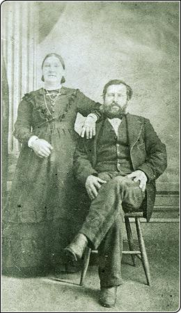
Jean-Baptiste Desautels (II) and his wife Julie Amyot, married in Saint-Paul de Joliette, Quebec in 1848. They moved to St. Paul, Minnesota in 1855 and continued on to Red River in 1864. The family settled first in Saint-François-Xavier, then in Lorette, and finally in Sainte-Anne-des Chênes in 1868. The "facteur Desautels" transported mail between Sainte-Anne, Saint-Boniface and Winnipeg along the Dawson Road for some 30 years.Source: Société historique de Saint-Boniface, Collection Générale, SHSB148. Retrieved July 2, 2020 from http://shsb.mb.ca/Jean-Baptiste_Desautels_Julie_Amyot_SHSB148 |
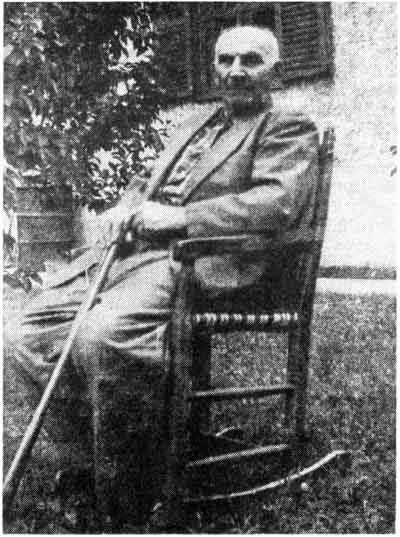
Alexandre Desautels seated in a chair made for his father in 1869 by the old Saulteux Chief, “Chair-Maker,” Faiseur des Chaises. Source: Madame Annette Dubuc Hébert. In the spring of 1869, the Desautels moved to Oak Point, now Ste. Anne des Chenes, two miles east of the village where his father bought a tract of land from the old Saulteaux Chief “Grandes Oreilles”. Alexandre Desautels dit Lapointe, Oldest St. Boniface College Student |
“Alexandre Desautels was the oldest St. Boniface College student (now Université de Saint-Boniface). Born on 25 July 1865 in a house which today would stand where now is the first pier of Provencher Bridge on the St. Boniface side of the Red River. His parents were Jean-Baptiste Desautels dit Lapointe and Julie Amyot, both born in St. Paul (Joliette), Quebec. When Alexandre was three years old, his family left St. Boniface to spend the winter at Lorette, seventeen miles south-east of St. Boniface.
"When Alexandre was twelve years old, a new school was built on the south-east corner of his father’s property. This school was called Ste. Anne East or L’Ecole entre les Deux-Rivieres, “The School between the Two Rivers” meaning the Seine River and the Coulee des Sources. This Coulee or “Stream” ran close to their home, where his father—after having built a dam already begun by beavers—had a Flour-mill and a Saw-mill for many years. At this “Ste. Anne East '' school, Mr. A. Lacerte was again his teacher for a term, followed by Mrs. Roch.
"When Alexandre was sixteen years old, he was sent in September 1881 to the St. Boniface College which was built early in the spring of that year. This college was destroyed by fire in 1922. Father Cherrier, later Monsignor Cherrier, was the first Rector. Alexandre studied at this college for five years, until May 1886, when he had to return home on account of illness.”
Annette Dubuc-Hébert
Source: Dubuc Hébert, A (September, 1958). Alexandre Desautels dit Lapointe, Oldest St. Boniface College Student. Manitoba Historical Society. Manitoba Pageant, Volume 4, Number 1. Retrieved June 27, 2020 from http://www.mhs.mb.ca/docs/pageant/04/desautels_jb.shtml
Tuyau
“The Road Allowance period (roughly 1900-1960) is a key but little known element of Métis history and identity. As immigrant farmers took up land in the Prairie provinces after the 1885 Northwest Resistance, many Métis dispersed to parkland and forested regions, while others squatted on Crown land used — or intended — for the creation of roads in rural areas or on other marginal pieces of land. As a result, the Métis began to be called the “road allowance people,” and they settled in dozens of makeshift communities throughout the three Prairie provinces ... Road allowance houses reflected the Métis’ extreme poverty — houses were usually uninsulated, roofed with tarpaper and built from discarded lumber or logs and various “recycled” materials. These small one- or two-room dwellings housed entire families.”
Indigenous Atlas of Canada
Source: Indigenous Peoples Atlas of Canada – Royal Canadian Geographical Society (Canadian Geographic). (2020). Road Allowance People. Atlas / Métis. Retrieved June 23, 2020 from https://indigenouspeoplesatlasofcanada.ca/article/road-allowance-people/
Barkwell, L. J. (2016). The Metis Homeland: Its Settlements and Communities (P.76). Louis Riel Institute. Retrieved from http://www.metismuseum.ca/resource.php/11956
La Coulée School
“Alexandre Desautels, son of Jean Baptiste Desautels dit Lapointe, recalls a new school being built on the south-east corner of his father’s property when he was twelve years old (in 1877). This school was called Ste. Anne East or L’École entre les Deux-Rivières, “The School between the Two Rivers” meaning the Seine River and the Coulée des Sources. This Coulée or “Stream” ran close to their home, where his father - after having built a dam already begun by beavers - had a Flour-mill and a sawmill for many years. At this “Ste.Anne East” school, Mr. A. Lacerte was his teacher for a term, followed by Mrs. Roch.”
Annette Dubuc-Hébert
Source: Dubuc Hébert, A (September, 1958). Alexandre Desautels dit Lapointe, Oldest St. Boniface College Student. Manitoba Historical Society. Manitoba Pageant, Volume 4, Number 1. Retrieved June 27, 2020 from http://www.mhs.mb.ca/docs/pageant/04/desautels_jb.shtml
|
|
|
|
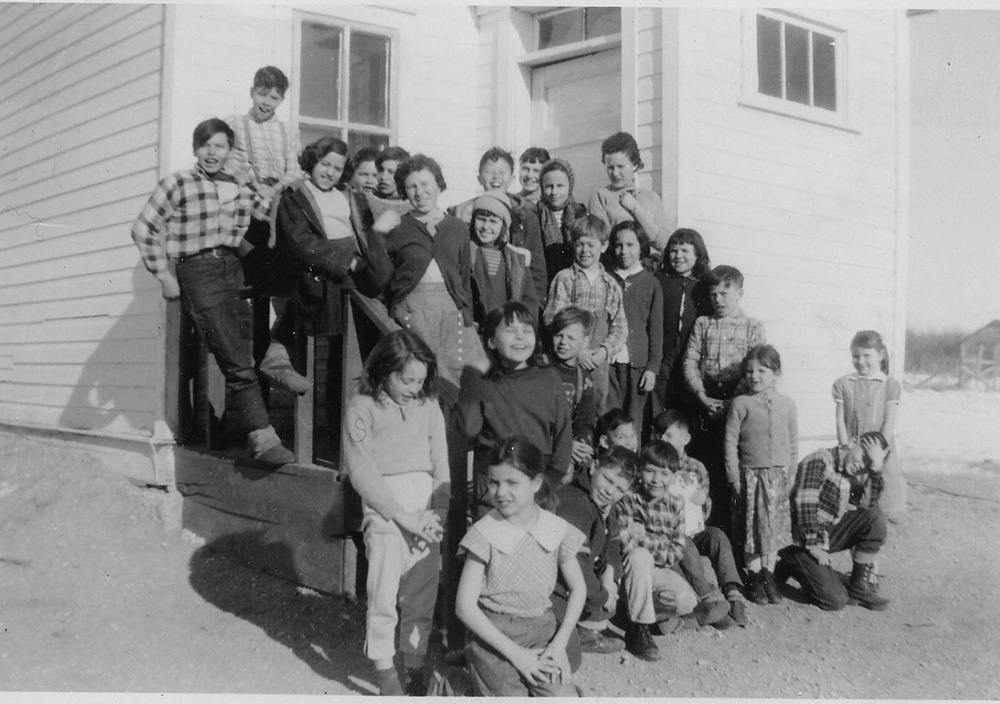
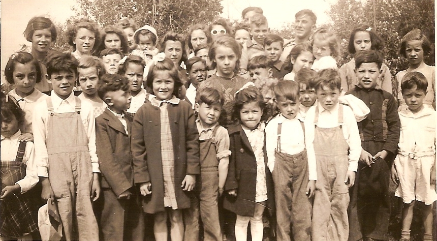
Students outside La Coulée school in 1943. The original school could be found North, along the Dawson Road. It closed down in the early 1960s and was moved to Aurèle Proulx’s property where it serves as a garage, to this day. Courtesy Evelyn Gagnon, local resident |
Students at La Coulée (1958). Courtesy Evelyn Gagnon, local resident |
|
The Proulx and Huppé families were among the first settlers of La Coulée. Paul Proulx (the first) served on Louis Riel’s Council.
|
|
Go to Next Tour Location: Côteau Pelé, aka Harrison’s Ridge | Top
Previous page: Where the Forest Meets the Western Prairies
Next page: Côteau Pelé, aka Harrison’s Ridge