POINT OF INTEREST: Prairie Grove and the Flowing Wells | Metis Travellers |
For Services Rendered | Guppy's Store
HISTORICAL NUGGETS CONNECTED WITH THIS LOCATION: Women in the "New West" |
“Compagnie de la Graisse” Early Animal Shelter | Eagle Bus Lines |
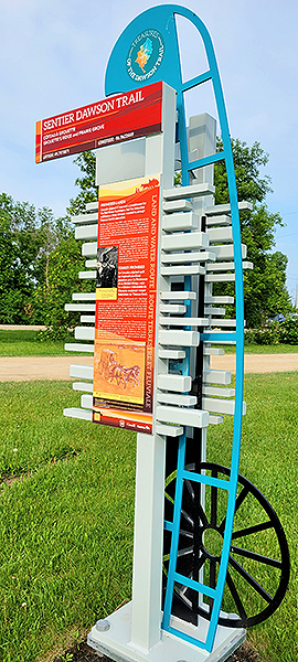 Commemorative Marker #13
SEE GOOGLE MAP LOCATION: 
Theme: "Grouette's Ridge" / McQuade's Place / English River
This marker is located in Prairie Grove Park, on Prairie Grove Road #54N just west of Dawson Road.
From Deacon's Corner (TransCanada Highway #1 and Highway #207 corner) travel south on Dawson Road (#207) approximately 2.5 kilometres.
At Prairie Grove Road #54N, turn right (west).
In just over 1 kilometre you will see the small village of Prairie Grove. At Dawson Road continue several metres to the Prairie Grove Park entrance.
Once you have finished visiting Prairie Grove, follow Dawson Road (gravel) south-east for 3.5 kilometres until it reconnects with the paved Hwy #207 Dawson Road, then turn right (south-east) to continue along the #207 towards Lorette.
There is a cemetery in Prairie Grove that you can visit if that interests you, if not just drive through and imagine how it used to be based on the photos below.
Prairie Grove and the Flowing Wells
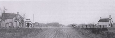
Town of Prairie Grove on the Dawson Trail. Source: Heather, D. (1968). Prairie Grove 1872-1968 (p.268). UM Archives, Manitoba Local Histories. Retrieved from http://hdl.handle.net/10719/3101128
“Located on the historic Dawson Trail the community of Prairie Grove began when a dozen intrepid families filed for homesteads in 1872. These homesteads were located at the north end of the river lots along the Seine River, in the middle of the land set aside for Métis grants, just south of the huge tract of land set aside for French Roman Catholic settlers from Quebec (RCM Property), just north of the already existing French Roman Catholic settlement of Petite-Pointe-des-Chenes (later named Lorette) and just west of the Military Bounty grants given to the soldiers who were brought in to quell the Métis Resistance. It was also an area where flowing wells were located that had been used by the Metis people for many years as they traveled from place to place.”
Diane Heather, Prairie Grove resident and author, 2014
Source: Heather, D. (2014). Prairie Grove History. Diane Heather personal collection.
Metis Travellers
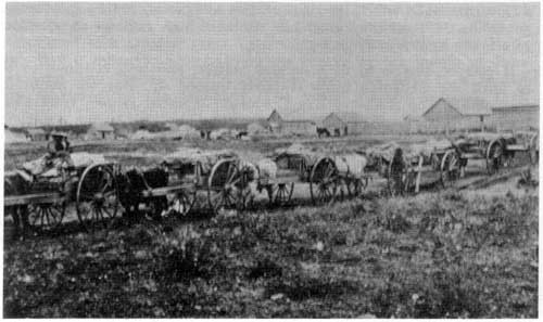
Métis Red River Cart train is presumed to be somewhere on the Dawson road in South-Eastern Manitoba. Source: Manitoba Historical Society. (n.d.) “The Lake Superior Route” [in Manitoba] 1890s, from The Nor’Wester. Manitoba Pageant, Winter 1967, Volume 12, Number 2. Source: Retrieved June 4, 2020 from http://www.mhs.mb.ca/docs/pageant/12/lakesuperiorroute.shtml
“The settlers who filed for homesteads in this area were Irish and Scottish Protestants from Ontario: Robertson, Nielson, McQuade, Dunlop, Cooper, Brewster, Nesbett and Wright. To say that there were strong feelings between them and their neighbours is likely an understatement. To say that our settlers did little to mitigate these feelings is likely also an understatement. They named part of their community Protestant Ridge until the postal authorities made them change it to something less inflammatory, some of them participated in meetings and activities of the Orange Lodge and they used various methods such as gunpowder in the fence rails to discourage the Metis from dismantling and burning their fences so they could access the flowing wells for their animals along the route.”
Diane Heather, Prairie Grove resident and author, 2014
Source: Heather, D. (2014). Prairie Grove History. Diane Heather personal collection.
For Services Rendered...
“For services rendered in the Red River Expedition, Wolseley's soldiers were given grants of 160 acres of land, exempt from the 3 years residency required of other homesteaders. The Métis struggled for years to get title to their land - even with prior ownership.”
Time-Life, 1981
Source: Time-Life Books Inc. (1981). The Canadians (P.148). Time-Life Series - Old West. Print
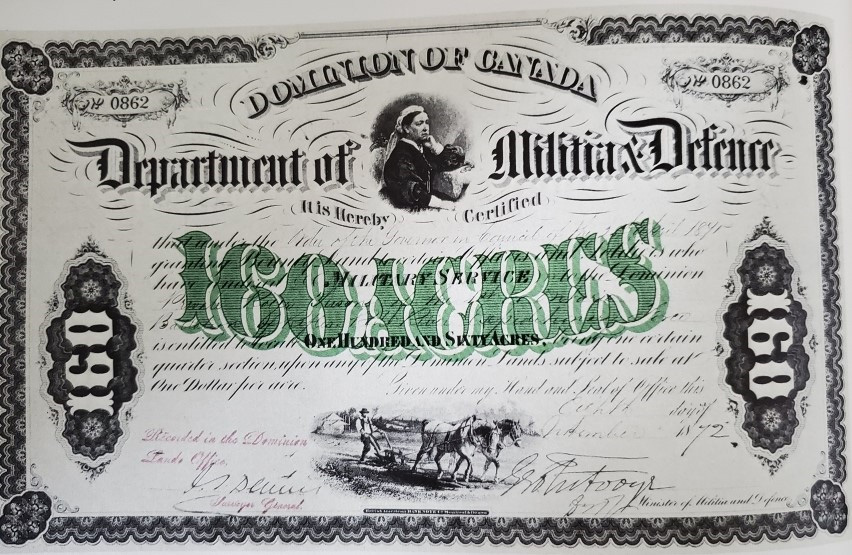
Bond for 160 acres of land for each of Wolseley’s volunteer soldiers. Source: Time-Life Books Inc. (1981). The Canadians (P.148). Time-Life Series - Old West. Print
Guppy's Store
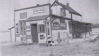
This was a typical stopping place along the Dawson Trail. This building in Prairie Grove was originally a store in front with attached two-story living quarters.
It was built at the corner of Dawson Road and Prairie Grove Road, and the post office occupied the N-W corner of the store. It later became Guppy’s.
Source: Heather, D. (1968). Prairie Grove 1872-1968 (P.18). UM Archives, Manitoba Local Histories. Retrieved from http://hdl.handle.net/10719/3101128
Guppy’s Store in Prairie Grove, Manitoba was either the first stopping place encountered along the Dawson Trail coming from Winnipeg or the last place encountered on the trail prior to arriving in Winnipeg. This photo was taken in 1963, long after the heyday of the Dawson road, after some upgrading. The barn that had been part of the stopping place was sold and moved to Dubinsky’s place. The windows were changed, the door was moved, the siding was replaced and the pump was upgraded. Source: Heather, D. (1968). Prairie Grove 1872-1968 (p.20). UM Archives, Manitoba Local Histories. Retrieved from http://hdl.handle.net/10719/3101128
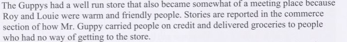
“Guppy carried people on credit and delivered groceries.” Source: Heather, D. (1968). Prairie Grove 1872-1968 (p.438). UM Archives, Manitoba Local Histories. Retrieved from http://hdl.handle.net/10719/3101128
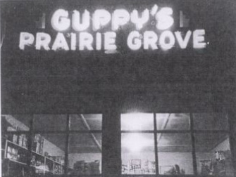
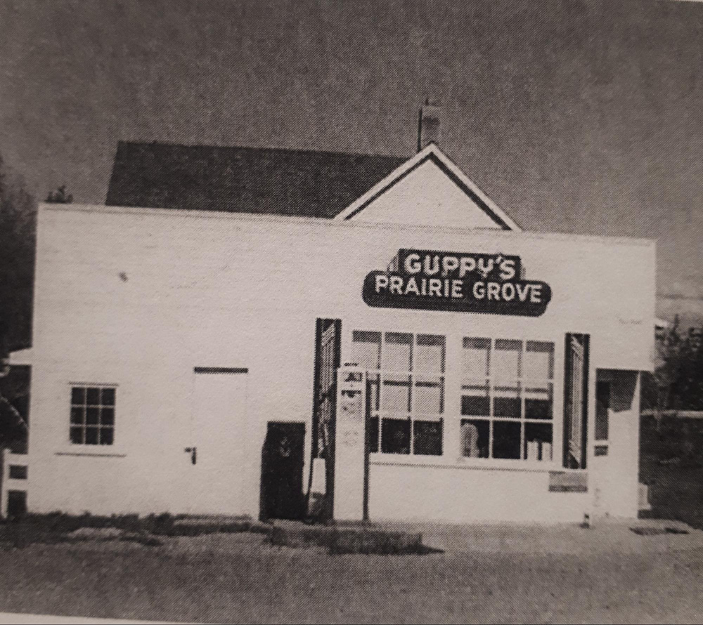
In 1940, Guppy’s got the first neon sign in a rural area in Manitoba. Lorne Larter remembers that everyone came out to see it light up. It was a community event! Source: Heather, D. (1968). Prairie Grove 1872-1968 (p.20). UM Archives, Manitoba Local Histories. Retrieved from http://hdl.handle.net/10719/3101128
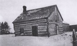
It is believed that this building (an empty house at the time) was used as the first school in the area until Heatherdale school was finished. Source: Heather, D. (1968). Prairie Grove 1872-1968 (p.93). UM Archives, Manitoba Local Histories. Retrieved from http://hdl.handle.net/10719/3101128
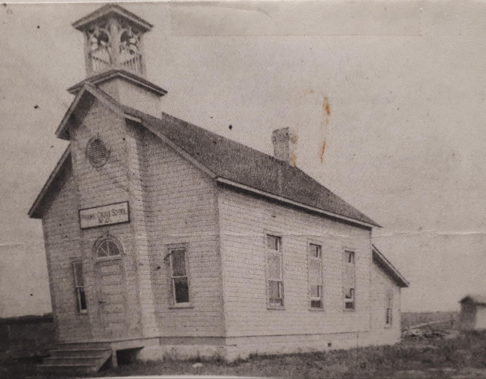
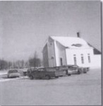
Heatherdale School in Prairie Grove (left) was later used as a chapel (right). Source: Heather, D. (1968). Prairie Grove 1872-1968 (P.103 and P.67). Manitoba Local Histories, respectively. UM Archives. Retrieved from http://hdl.handle.net/10719/3101128
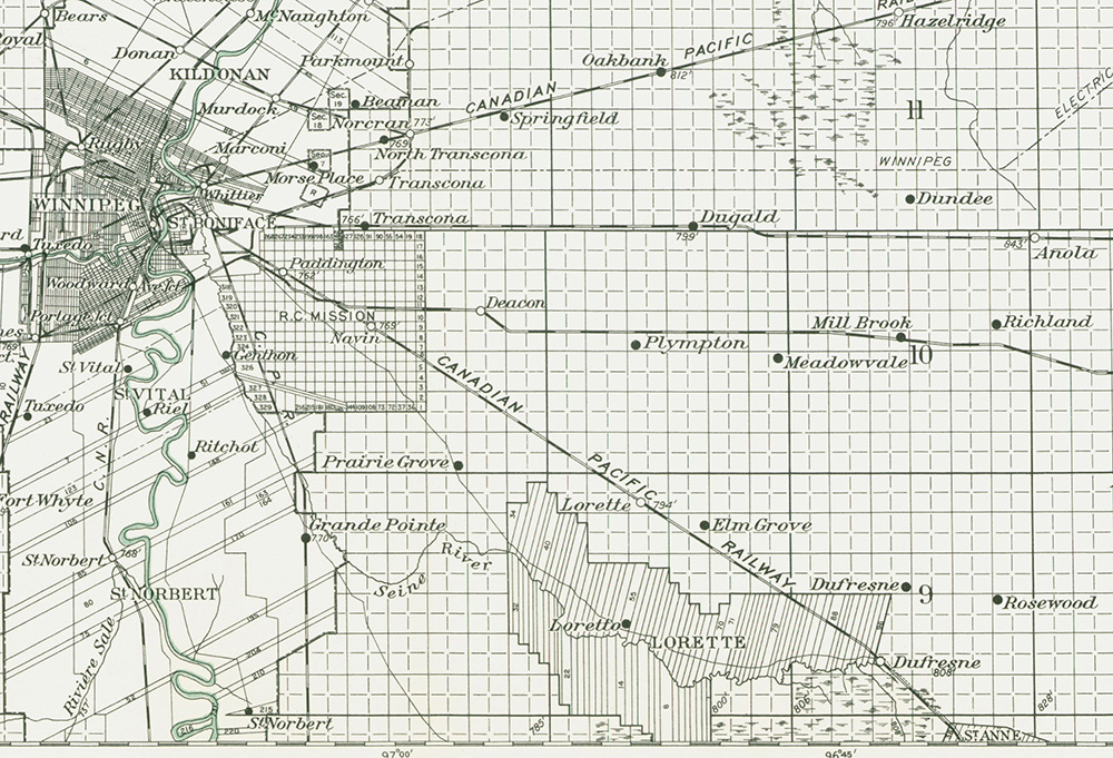
Winnipeg Sheet, Manitoba, East and West of Principal Meridian, October 1917. Map shows towns and survey patterns of villages along the Dawson Road from Lorette to St. Boniface including Prairie Grove. French and Michif-speaking communities had developed around a river lot system as seen around Lorette, and tensions rose when the new Canadian Government imposed a square grid system. Source: Province of Manitoba. Retrieved from https://www.flickr.com/photos/manitobamaps/page10/
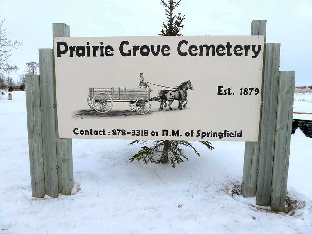
Sign from the entrance of Prairie Grove Cemetery on Dawson Road, still well taken care of in December 2019. Photo credit: Mireille Lamontagne
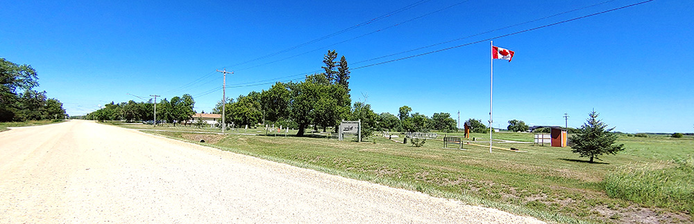
Prairie Grove Cemetery is located at 266 Dawson Road. Photo by Myriam Dyck.
Go to Next Tour Location: Red River Cart Display | Top
Previous page: Lagimodière Boulevard
Next page: Red River Ox Cart Exhibit