Sainte-Anne: Heart of the Dawson Road
“The Dawson Road was surveyed and constructed at a time when the areas of Richer, Sainte-Anne and Lorette were referred to as “Côteau des chênes”, “Grande pointe des chênes” and “Petite pointe des chênes” respectively. These villages were considered part of French-speaking parishes of the Red River Colony which had been settled along the banks of the Red, Assiniboine and Seine Rivers further west where St. Boniface and Winnipeg can be found today. The southeast region was not only the first part of the province newcomers encountered on their journey from the east in the 1870s, but played an essential role in providing hunting grounds and wood for fuel and construction for the Red River Settlement. For example, the wood used for construction of the St. Boniface Cathedral was sourced in the area of Ste. Anne around 1830."
History of the Parish of Ste-Anne-des-Chênes, 1876-1976
Source: Villa Youville Inc. (1976). Paroisse de Ste. Anne des Chênes 1876-1976 (p.30). Published by « le Comité historique du Centenaire, » Ste-Anne, Manitoba. Retrieved June 3, 2020 from http://www.mb1870.org/localhistory/125%20-%20La%20Paroisse%20de%20Ste.%20Anne-des-Chenes.pdf
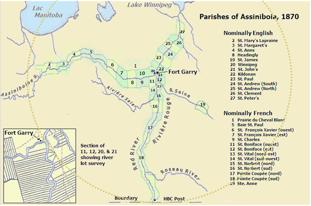
The twenty-seven (27) parishes of the Red River Settlement in the Red River Colony, known as the District of Assiniboia (under the HBC regime) are numbered along this 1870 map of the settlement just before Manitoba’s entry into Confederation. Its parishes ran up and down the Red, Assiniboine and Seine Rivers. In 1856, Ste. Anne, number nineteen (19) on the map along the Seine River, was the first to organize itself formally as a parish, though other parishes, such as St. John’s, St. Boniface, Kildonan, St. Vital and St. Norbert were settled earlier and had churches. Retrieved June 4, 2020 from The Home Country of Assiniboia
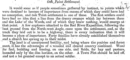
“Oak Point Settlement,” from Report on the Line of Route Between Lake Superior and the Red River Settlement by Simon J. Dawson, civil engineer (P.26). Printed by order for the House of Commons. Ottawa. Printed by I.B. Taylor at the “Ottawa Citizen” office1869. Peel Library, University of Alberta. Retrieved June 29, 2020 from http://peel.library.ualberta.ca/bibliography/481/reader.html#25
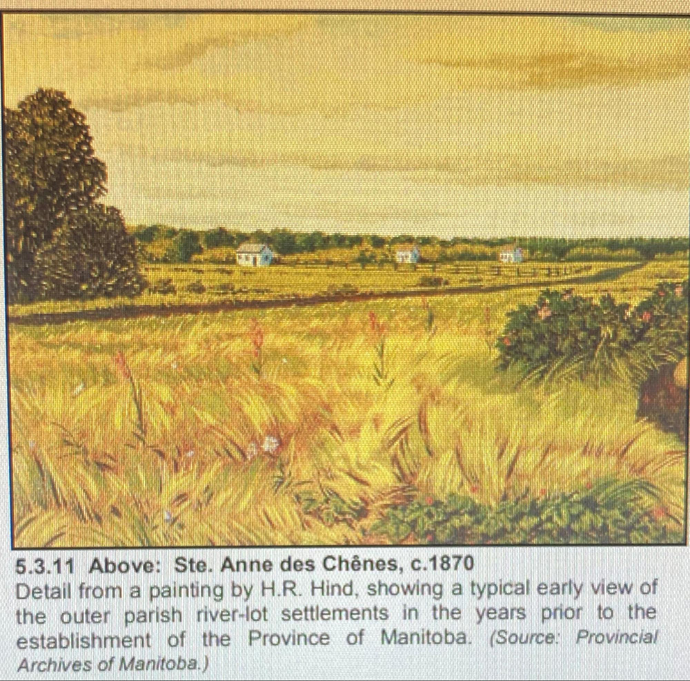
The only known painting of the parish of Sainte-Anne-des-Chênes, Manitoba circa 1870, by H. Richardson Hind. H. Richardson was a brother of Henry Youle Hind. Note the trail going through it that would become the Dawson Road soon after. At this time, the road from St. Boniface to Ste. Anne was still known as Gaudet road (chemin de Gaudet). Note how close the farmhouses are to one another. This physical closeness to neighbours created a sense of community cohesion, threatened by a square grid surveying system intended to spread settlers out. Source: Toronto Public Library, “Roadside Scene with Three Houses and Figure”, Picture, 1870, English, https://www.torontopubliclibrary.ca/detail.jsp?Entt=RDMDC-941-3-37&R=DC-941-3-37
Go to Next Tour Location: Pioneer Park Exhibit | Top
Previous page: “La Grande Traverse”
Next page: Pioneer Park Exhibit