Segments of the trail are still in use today in both Manitoba and Ontario. Ontario Highways 102 and 11 follow Dawson Road from Thunder Bay to Shebandowan. From there, Highway 11 generally follows the original water route west to Rainy River. The water portion of the route is still used by canoeists and runs along the international boundary line.
In Manitoba, the abandoned road between Northwest Angle and Richer has fallen into disrepair, but can still be accessed via the Trans-Canada Highway from the north and Provincial Road 308 from the east.
Between the communities of Richer and Lorette, Dawson Road has been incorporated into Provincial Road 207. Sections of Dawson Road in and near Winnipeg remain active and bear the original name, but have been disconnected since the construction of the Red River Floodway and Lagimodiere Boulevard.
Sources:Wikipedia contributors. (2020, June 15). Old Dawson Trail. In Wikipedia, The Free Encyclopedia. Retrieved 19:25, June 21, 2020, from https://en.wikipedia.org/w/index.php?title=Old_Dawson_Trail&oldid=962602581
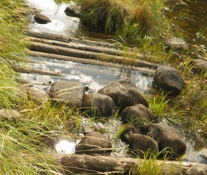
The Dawson Trail today near Lake of the Woods (2019). Note pieces of corduroy road coming out of the swamp. These remnants of pilings of corduroy road are likely from the 1968-70 Canada-Manitoba centennial project to rebuild sections of the road and not the original corduroy road, however it gives a good sense of what the terrain was like to travel on. Photo credit: Nancy D. Evans.
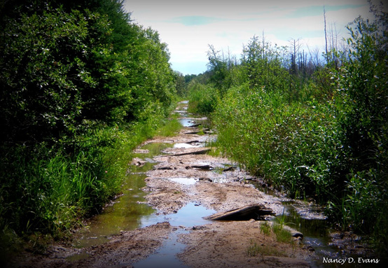
The Dawson Trail today near Lake of the Woods (2019). Photo credit: Nancy D. Evans.
Next: Route of the Dawson Trail | Top
Previous page: Dawson Route Distances
Next page: Route of the Dawson Trail