Pioneer Park Exhibit
SEE GOOGLE MAP LOCATION: 
As you travel east on the gravel section of Dawson Road #207, you come to a paved off-ramp and underpass for Highway #12 - turn right (east) and go under the underpass.
You arrive in the Town of Sainte-Anne. On the right side you will see the Pioneer Park display.
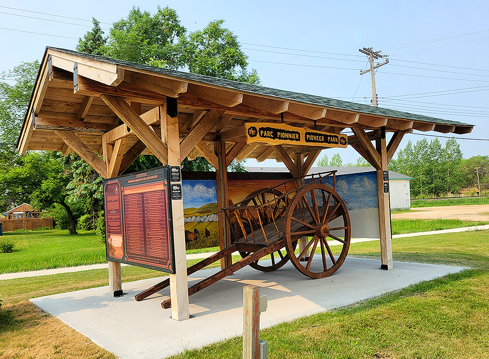
This exhibit is dedicated to the brave and hard-working pioneer families who settled in this area in the mid to late 1800’s. The Pioneer Site is a collaborative initiative led by Sainte-Anne resident Norman Lavack and made possible by a committee of local community volunteers and donors. Among these, the Red River cart was built by Maurice Tétreault, the Interpretive Map of the Dawson Trail and panels listing the early pioneer families were designed and provided by the Dawson Trail Arts and Heritage Tour, and the background painting is the work of local artist Ken Malo. Research relevant to the pioneer families was sourced from the ‘Ste-Anne Parish Centennial Book 1876-1976’, made possible by ‘La Société Franco-Manitobaine’, and early census records. Special attention has been given to recognize the Métis people and the women, whose names are too often overlooked and forgotten.
Sainte-Anne Pioneer Families
In recognition of our Pioneer Families, a list of some 290 Pioneer Families between 1850 and 1890 has been researched and presented in two formats; one in alphabetical order of the men and the other in alphabetical order of the women. In so doing it is much easier to locate your ancestors on the male or female side.
View the list of Sainte-Anne Pioneer Families
Go to Next Tour Location: Sainte-Anne Old Municipal Hall | Top
Previous page: Sainte-Anne: Grande pointe des chênes
Next page: Sainte-Anne Old Municipal Hall