POINT OF INTEREST: East Braintree Marker
HISTORICAL NUGGETS:
Birch River Station for Weary Travelers
Manitoba Industrial Prison Farm
 East Braintree: Marker #2
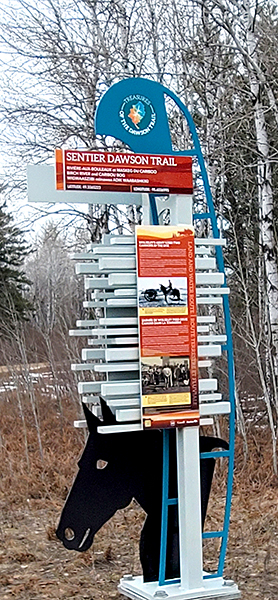
This marker is approximately 50 kilometers east of the Eastman ATV Staging area on the Trans-Canada Highway and then to the south on gravel roads, at East Braintree Road & #503.
We recommend you drive north from from the Eastman ATV Staging area 1 km to the Trans-Canada Highway #1, turn east and go 47.6 kms, then turn right onto MB-308 S (signs for East Braintree) and go south for 2.4 kms, then turn right onto E. Braintree Rd. for 7.4 kms.
The final marker at Harrison Creek is not accessible by road, only by snowmobile over winter roads - you can read all about the Harrison Creek marker here.
After you have seen the East Braintree marker, your next tour location is the Ross Church Bell Monument.
From the East Braintree marker drive north on E Braintree Rd toward McMunn Rd 41N for 7.0 km, then turn right to stay on E Braintree Rd for 350 m, then turn left onto MB-308 N for 3.1 km. At the Hwy #1E Trans-Canada Hwy turn left and go 61.4 kms back to Richer. At Richer, turn right (north) on Hwy #302 and go 10 kms until you reach Hwy #501, then turn right (east) and go 1.5 kms, then turn left (north) on Municipal Rd. #45E to arrive at your next Tour Location of Ross, Manitoba.
“At Brokenhead or Tête Ouverte was located the first travelers’ station within the original eastern boundary of the Province of Manitoba.”
Harvey Goldberg, Researcher and C.B. Gill, Parks Consultant,
Historic Resources Branch, Manitoba, 1969
Source: Harvey Goldberg, Researcher, and C.B. Gill, Parks Consultant, Field Notes, Wording approved (1969) for historical markers that were never erected. Historic Resources Branch, Province of Manitoba.
“The Government has, with a wise forethought for the comfort of emigrants and passing troops, established along the Dawson road depots or stations at intervals where rivers or creeks intersect or approximate the road. The station-keepers are generally married men, their wives acting as cooks; and are provided with a neat log hut, commodious stables and supplies of floury pork, hard biscuit, tea, sugar, potatoes, molasses, dried apples, etc, of good quality. They are very kind and attentive to all persons, and are not allowed to receive payment from emigrants or persons in Government employ. To prevent impositions, the former have their tickets, and the latter are supplied with passes from some of the government’s agents on the road.”
Sir Sanford Fleming on his trip to Manitoba in 1873
Source: Grant, G.M., 1835-1902. (1873). Ocean to ocean: Sandford Fleming’s expedition through Canada in 1872. Being a diary kept during a journey from the Atlantic to the Pacific with the expedition of the engineer-in-chief of the Canadian Pacific and Intercolonial railways (P.71). BC Historical Books. Diaries. Retrieved June 3, 2020, from https://open.library.ubc.ca/collections/bcbooks/items/1.0221770
Go to Next Tour Location: Harrison Creek Marker | Top
Previous page: East End of Current Dawson Road
Next page: Harrison Creek