SEE GOOGLE MAP LOCATION 
POINT OF INTEREST: Côteau Pelé, aka Harrison’s Ridge | Lake Riviera
HISTORICAL NUGGETS: Workers Revolt: The “Dunking” of John Snow
The Rise of Political and Social Turmoil
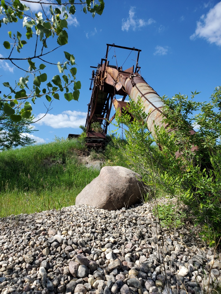
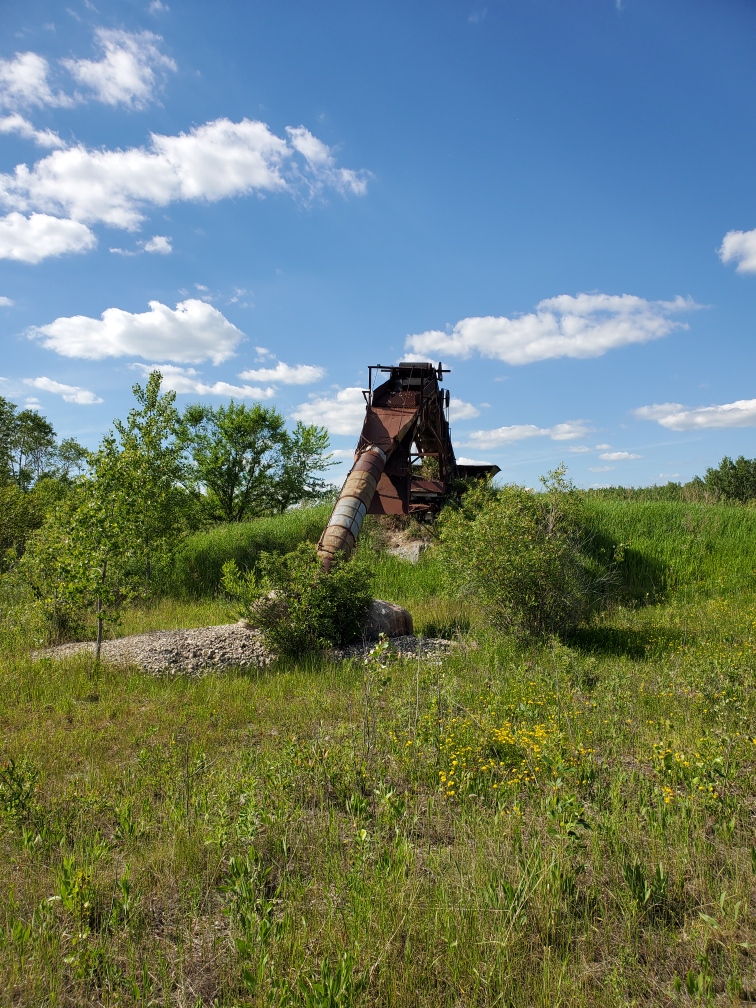
As you continue eastward through La Coulee on the Dawson Road #207, just past Paradise Road on your left (north side) you will see remains of the gravel pit and construction equipment (pictured in next section below).
On your right (south side) you will see Lake Riviera Estates, which is now a gated community (private property - do not enter).
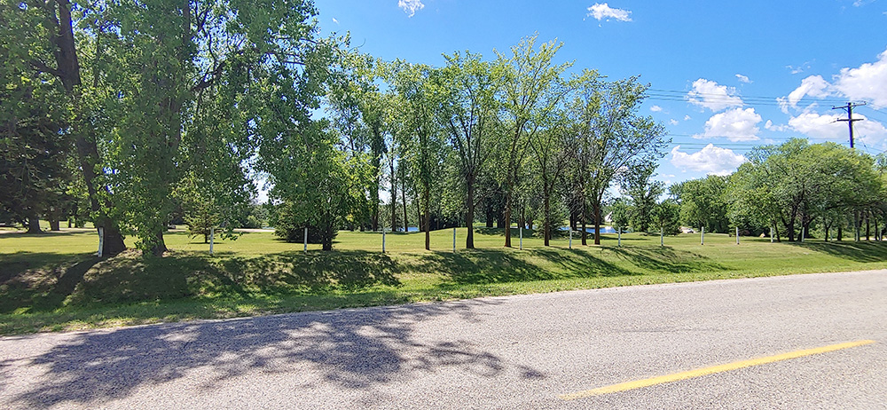
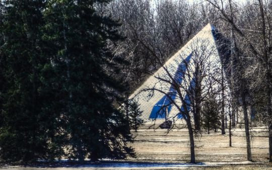
Lake Riviera Estates viewed from #207. On the other side of the lake you can glimpse the pyramid house. Photo credit Myriam Dyck
Côteau Pelé, aka Harrison’s Ridge
The silty ridges that run throughout southern Manitoba in a North-West to South-East direction are the remnants of the beaches of giant ancient glacial Lake Agassiz formed from the thaw of the last Ice Age about 10,000-3,000 years ago. These ridges were used by First Nations since time immemorial to navigate across the swamps that have since been largely drained for agricultural purposes, leaving sometimes only hints as to what that former landscape looked like. Côteau Pelé is one of these ridges and includes the Lake Riviera area, the small gravel pit north of the Dawson Road and the full extent of the “côteau” or ridge that continues north past the TransCanada highway. On this ridge, on land belonging then to Jean-Baptiste Desautels, Snow built his headquarters for the construction of the Dawson Road. According to the oldest resident of La Coulée, and the owner of the land, Aurèle Proulx, the gravel ridge was once as much as 20 to 30 feet higher than it is today.
|
|
|
|
Côteau Pelé, aka Harrison’s Ridge, property of Mr. Aurèle Proulx (2020, June). Photo credit: Pierrette Sherwood. |
Once 20-30 feet higher than seen in this photo, the silt and gravel from Côteau Pelé was used to build the Dawson Road (2020, June). Photo credit: Pierrette Sherwood |
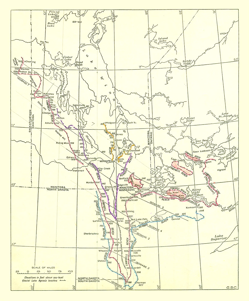
This map shows the various shorelines of ancient glacial Lake Agassiz, once the greatest lake in the world, over time. Note the ancient beach ridge line that cuts through to southeastern Manitoba all the way to Lake of the Woods that was used to its maximum advantage in the building of Dawson Road. Source: CBC News with Bill Redekop. (2017, Nov 5). Lake Agassiz: New book explores origins, discovery of giant phantom lake. Retrieved June 25, 2020 from https://www.cbc.ca/news/canada/manitoba/lake-agassiz-book-bill-redekop-1.4388326
"The beaches of Lake Agassiz commonly rise three to 10 feet [one to three metres] above the adjoining land on the side that was away from the lake, and 10 to 20 feet [three to seven metres] above the adjoining land on the side where the lake lay. In breadth, these beach ridges vary from 10 to 25 or 30 rods [from 50 to 150 metres]. The beach ridge is thus a broad wave-like swell, with a smooth gracefully rounded surface."
Warren Upham, who has mapped the beaches of Lake Agassiz
Source: CBC News with Bill Redekop. (2017, Nov 5). Lake Agassiz: New book explores origins, discovery of giant phantom lake. Retrieved June 25, 2020 from https://www.cbc.ca/news/canada/manitoba/lake-agassiz-book-bill-redekop-1.4388326
Lake Riviera
“Ste. Anne farmer Bill Walker and his brother Tom Walker hired “Fast Brothers” in the fall of 1958 to build a huge (earthen) dam to turn a dry creek east of Ste. Anne into a summer resort. Lake Riviera, a huge artificial lake, cost $100,000 before it opened in June, 1959.
"Public response was nothing short of fantastic, right from the day it opened. Bathers, boaters and water-skiers and picnickers began flocking out to this 20-acre made lake, four miles east of Ste.Anne. A special bus service from Winnipeg left the bus depot at 11:30 a.m. and returned at 8:30 p.m. The return fare of $1.50 per person included admission to the lake.
"Each week the crowds have been getting bigger, and the third week in July the crowd was estimated at 5000. Already, Lake Riviera had 44 employees, including five lifeguards and 11 security men to police the grounds. Swimming facilities at the lake include a nine-foot diving tower, a diving board, a fenced off children’s swimming area and a number of boats. The lake was 25 feet deep at the deepest spot.
"Two artesian wells constantly add fresh water to the lake in addition to the stream. Engineers believe that even if the stream were to dry up, the wells will supply enough water for a continuous overflow over the 1,100 foot dam that holds the 20-acre lake.”
Wes Keating, local journalist, 1959
Source: Steinbach Carillon, Steinbach, Manitoba, CA, July 24, 1959 (P.5). Official opening of Lake Rivera by Wes Keating. Retrieved June 27, 2020 from https://newspaperarchive.com/ca/mb/steinbach/steinbach-carillon/1959/jul-24-p-5/
Zigarlick, Eldon saved to Travel In Manitoba Pyramid House - Lake Riviera - La Coulee, Manitoba. A severe flood in 1974 washed out the dam. Lake Riviera is now a private, gated housing development. Retrieved from: https://www.pinterest.ca/pin/425027283565045370/
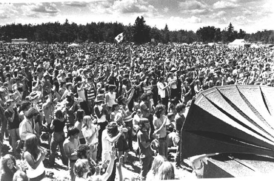
Speaker blares out the music...Lake Riviera. Source: Winnipeg Tribune, June 13, 1971. Photo credit: Burner. Rock and Pop Music 1970-1980. Call Num: PC 18/5754/18-4902-010. Retrieved from http://umanitoba.ca/libraries/units/archives/tribune/photographs/display_photo.php?id=5578
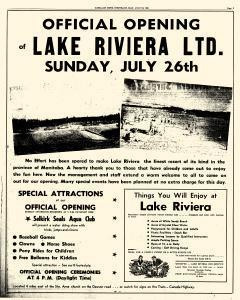
Poster advertising the official opening of Lake Riviera at La Coulée on Sunday, July 26, 1959. Steinbach Carillon, July 24, 1959. Retrieved from https://newspaperarchive.com/ca/mb/steinbach/steinbach-carillon/1959/jul-24-p-5/ (poster is available for purchase through newspaper archive)
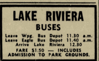
Advertisement for bus pick-up and drop-off round trip from Winnipeg to Lake Riviera. Winnipeg Tribune, July 28, 1959 (P.8). Retrieved from https://newspaperarchive.com/other-articles-clipping-jul-28-1959-1766885/
 Marker #7 - Coming Soon
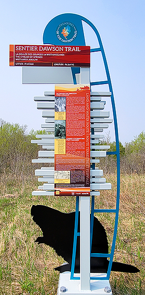
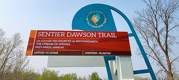
Theme: "Creek of the springs" or "Creek of Resources" / "Great Beaver Dam" or "Mistamiscano"
This marker is located in the future park of a residential development. It is not currently available for visiting until the development has created the road and access. Please wait until it is publicly available and safe to access.
Go to Next Tour Location: Thurston Park Exhibits | Top
Previous page: La Coulèe des Ressources
Next page: Thurston Park Exhibits