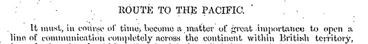
“Route to the Pacific”, Report on the Line of Route Between Lake Superior and the Red River Settlement by Simon J. Dawson, civil engineer (P.13). Printed by order for the House of Commons. Ottawa. Printed by I.B. Taylor at the “Ottawa Citizen” office1869. Peel Library, University of Alberta. Retrieved from http://peel.library.ualberta.ca/bibliography/481/reader.html#4
The full length of the historic Dawson Route from Thunder Bay on Lake Superior to Fort Garry (Winnipeg) covered a distance of 850 kms (or 530 miles), including 240 kms (or 150 miles) of road on land and 611 kms (or 380 miles) on water.
Sources:
Canada: General Report of the Minister of Public Works. (1867-1882). Chapter 7 Volume 2. North-West Communication, p. 650. Retrieved June 3, 2020 from https://books.google.ca/books?id=8gxOAQAAMAAJ...
Wikipedia contributors. (2020, June 15). Old Dawson Trail. In Wikipedia, The Free Encyclopedia. Retrieved 19:25, June 21, 2020, from https://en.wikipedia.org/w/index.php?title=Old_Dawson_Trail&oldid=962602581
Corduroy Road
Corduroy road made of timber had to be built on either end of the water route to make it navigable. At the eastern terminus of the route in Ontario, a road was built at Port Arthur-Lake Shebandowan. At the western terminus in Manitoba, the Dawson Trail (or Road) went for about 145km (90 miles). The landing for steamboats that replaced canoe travel on Lake of the Woods landed at its NorthWest Angle, which jogs into Harrison Creek. This is where travel by Red River Cart, by horseback or by walking began to Fort Garry. It was also sometimes referred to as Fort Garry Road.
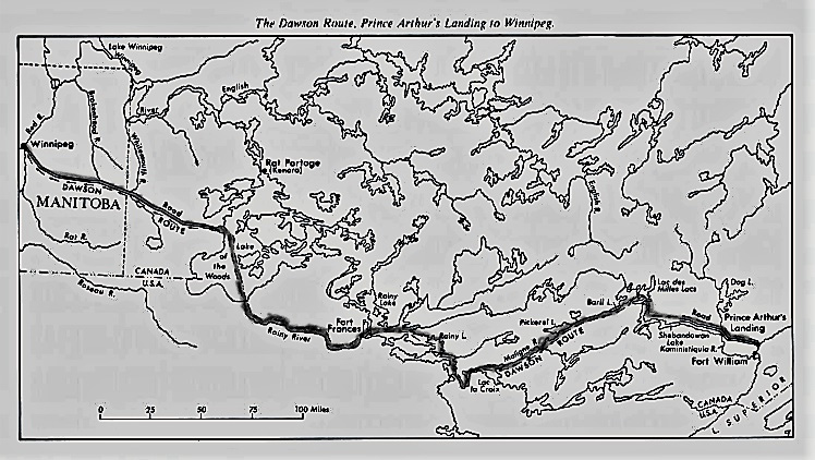
The Beaver Magazine. Map of “Mr. Dawson’s Road” by Jack Manore. February-March, 1991 (P.10). Route retraced digitally in pencil by Mireille Lamontagne, May 2020. Retrieved June 4, 2020 from https://canadashistory.partica.online/canadas-history/the-beaver-feb-mar-1991/flipbook/10/
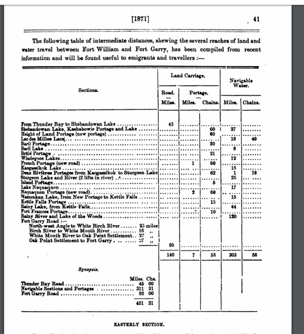
Table of intermediate distances between each place along the Dawson Route in “North-West Communication” from Canada: General Report of the Minister of Public Works (1867-1882), Chapter 7, Volume 2 (P.650). Retrieved June 3, 2020 from https://books.google.ca/books?id=8gxOAQAAMAAJ...
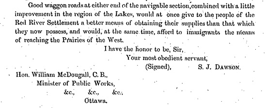
“Good waggon roads at either end.” Summary of the Report on the Line of Route Between Lake Superior and the Red River Settlement by Simon J. Dawson, civil engineer (P.12). Printed by order for the House of Commons. Ottawa. Printed by I.B. Taylor at the “Ottawa Citizen” office (1869), Peel Library, University of Alberta. Retrieved from http://peel.library.ualberta.ca/bibliography/481/reader.html#4
Next: Is Dawson Trail Navigable Today? | Top
Previous page: What is the Dawson Trail?
Next page: Is Dawson Trail Navigable Today?