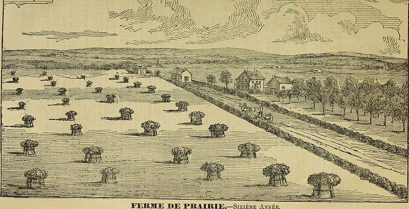
Typical prairie river lot farm in Métis and French-speaking parishes of the Red River settlement. Source: Canada : Department of Agriculture. (1880). La province du Manitoba et le territoire du Nord-Oeust : Information pour les immigrants.Queens University Library. Retrieved June 29, 2020 from Wikimedia Commons, https://www.flickr.com/photos/internetarchivebookimages/tags/bookidlaprovincedumani00cana
“The area contained within the Dawson Trail region includes one of Manitoba’s largest French-speaking settlement enclaves. Beginning with the French explorers and coureurs de bois, continuing with the Métis riverfront settlements and wintering camps, and finally blossoming with thousands of mostly expatriate French Canadians from the New England states, the French-speaking presence in the Dawson Trail region is a long and colourful one.
“Beginning in 1872, the Roman Catholic Church began actively to promote French settlement to help preserve and strengthen the language rights won in the Manitoba Act of 1870, which created the Province of Manitoba. The St. Boniface Diocese, under the leadership of Archbishop Taché, had hoped to create a solid block of French-speaking Roman Catholic communities in southeastern Manitoba. Although that dream ended with the creation of the Mennonite East Reserve in 1874, in the heart of the southeastern region, several thousand French settlers were enticed to come to Manitoba. Through the Société de Colonisation du Manitoba, the Roman Catholic Church authorities in Manitoba were able to arrange for the creation of special river-lot settlements to be carved out of the township grid. Six such settlements were eventually established, includes Ste. Anne, Lorette, and Grande Pointe settlements along the Seine; the Rat River (St. Pierre) and St. Malo settlements along the Rat River; and finally, an unusual situation in which the Ȋle-des-Chênes Settlement was established along a segment of the former Oak River channel.”…”In support of these and other French settlements, the Roman Catholic Church authorities were actively involved in real estate dealings throughout southern and southeastern Manitoba, and were involved in the purpose and resale of large amounts of Métis Scrip land in the region.”
“The long-lot survey was the dominant system of land division in Québec since its founding. When the Selkirk Settlers established the Red River Colony in 1812, the advantages of this system were noted by the colony patron, Lord Selkirk, who was living in Montreal at the time, and suggested it as the manner in which his settlement should be organized. By 1870, the system of river-lot parish settlements thus created, extended up and down the banks of the Red and Assiniboine rivers for up to 50 kilometres (31 miles) from the settlement core at The Forks. These existing river-lot parishes were re-surveyed as part of the Dominion Survey and extended to Portage la Prairie on the Assiniboine and to the US border south of the colony along the Red River. Thus the long-lot or river-lot system of land holding was familiar to both the indigenous French Métis and the incoming French settlers. The creation of the new river-lot parishes along the Red and Assiniboine rivers, and the special survey of the six 'outer river-lot parishes' was used by the Roman Catholic Church as an additional tool in attracting French settlers to this region of Manitoba by providing a familiar, and therefore comfortable, physical environment in which to live.”
Edward Ledohowski, Historic Resources Branch, 2003
Source: Province of Manitoba, Culture, Heritage and Tourism. Authored by Edward M. Ledohowski of the Historic Resources Branch (2003). “The Heritage Landscape of the Crow Wing Study Region of Southeastern Manitoba”, 5.0 Settlement Groups (P.42). Retrieved March 5, 2020 from https://www.gov.mb.ca/chc/hrb/internal_reports/pdfs/crow_wing_settlement_groups.pdf
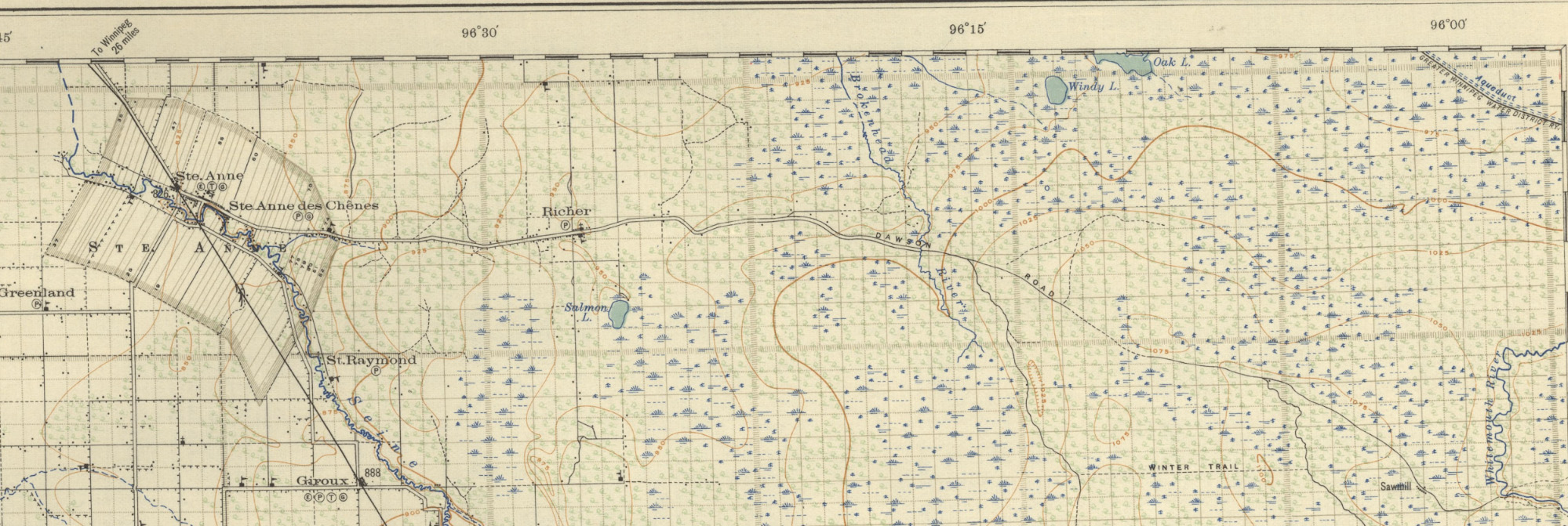
Southeast Manitoba close-up of Sectional Map No. 23 of Manitoba on either side of the meridian, 1922, Province of Manitoba. Close up image of traditional river lot system in the region’s Métis and French-Canadian communities. Retrieved from Emerson Sectional Map 23 (1922) | Sectional map no. 23: Emer…
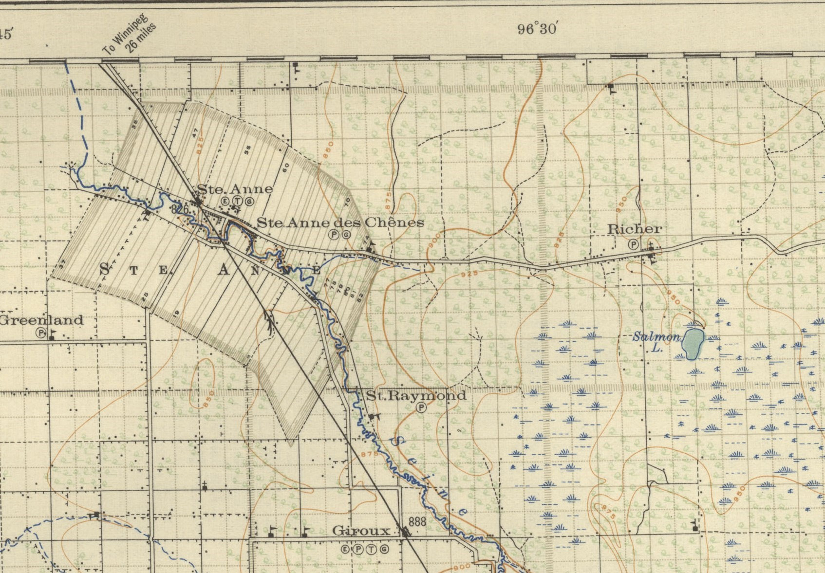
Note the river lot system identified on this map for the Parish of Ste. Anne in comparison to the square grid system used by the Canadian Government. Parish of Ste. Anne on Sectional Map No. 23 of Manitoba on either side of the meridian, 1922, Province of Manitoba. Close up image of traditional river lot system in the region’s Métis and French-Canadian communities. Retrieved from https://www.flickr.com/photos/manitobamaps/3681736953
Back to Sainte Anne des Chenes Roman Catholic Church Heritage Tour page | Top
Previous page: Canadian Pacific Railway Supersedes the Dawson Trail by 1885
Next page: Early Surveyors Meet with Resistance