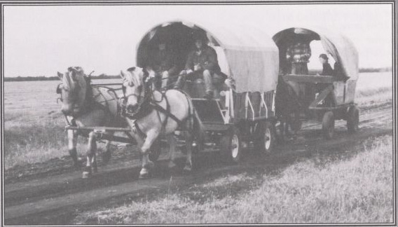
Covered waggons on or near the Dawson Trail. Laing, E. & Laing, A. (1869). Pioneers of Clear Springs: The land of springs, coulees and rich loamy soil, Clear Spring beginnings with memory connections (Part 1, p1). Retrieved June 9, 2020 from http://hdl.handle.net/10719/3101800
“When Manitoba became a province, it set about organizing the territory. The fur trade was beginning to languish and it was time to get settlers to settle the land and reap the great harvests. The Government set up a great campaign to attract settlers to the land. People from Europe came in droves to settle in Manitoba. Much of the land in the R.M. of Taché was held by non-resident owners. (…)
"The tax rolls of the Municipality read like the addresses of the U.N. members. There were absentee owners from Victoria Square, Montreal, Ashdown, Ogilvie Milling co., The London and Ontario Investment Co., The London and Cdn. Loan Agency Co., owners from San Diego, Santa Anna, California; Portage la Prairie, Selkirk, Winnipeg, North Dakota, Toronto, Ontario; Orillia, Ontario, Rat Portage, Ontario; Prince Albert, Saskatchewan; Vancouver, B.C.; Zarzinski of Austria and many, many more.
"Agricultural land was open to Homestead Entry of 160 acres, available to any head of family or male over 21 years of age for as little as $10.00.”
Rose R. Blom, author of the R.M. of Taché centennial history book, 1980
Source: Blom, R.R. (1980, April). Taché Rural Municipality 1880-1980 (p.10). Commissioned by The Council of the Rural Municipality of Taché. Derksen Printers, Steinbach: Manitoba. Retrieved from University of Manitoba digital collections June 3, 2020, http://hdl.handle.net/10719/3055598
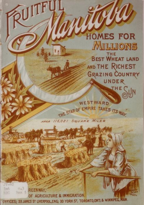
Cover of “Fruitful Manitoba,” the memoirs of Jean Monnet, French statesman and founder of the European Economic Community, as an eighteen-year-old salesman traveling in Winnipeg and Calgary in 1906. His Memoir was translated and published by Richard Mayne in 1978. University of Manitoba Archives and Special Collections. Jean Monnet Centre for International Law, Harvard Law School, New York, NY. Retrieved June 15, 2020 from https://digitalcollections.lib.umanitoba.ca/islandora/object/uofm:2694575
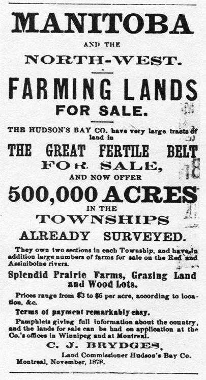
Typical advertisement posted in the East for farming lands for sale in Manitoba and the North-West. Riel Rebellion — Rébellion du Nord-Ouest. Begbie Contest Society. Retrieved June 5, 2020 from Riel Rebellion
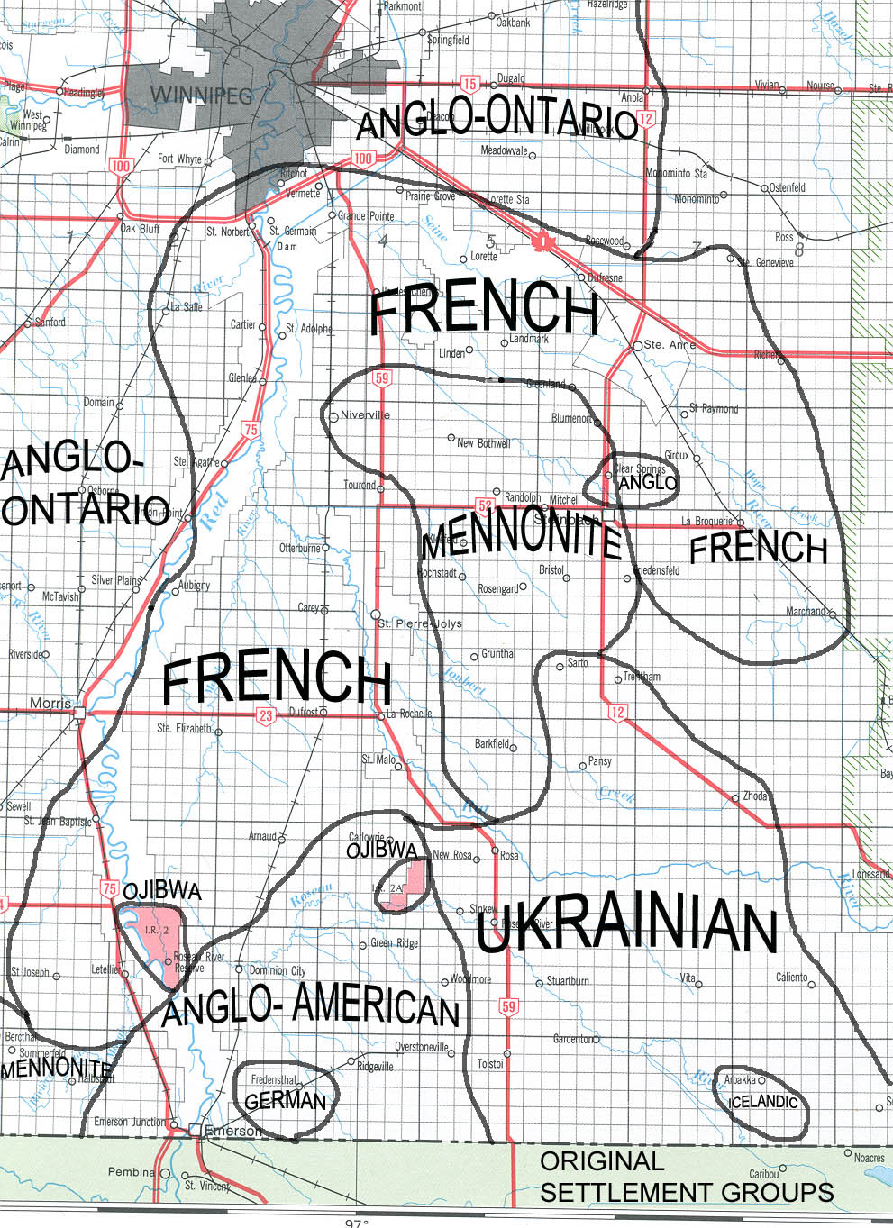
Settlement groups in Southeastern Manitoba following the Dominion Lands Survey and the Homestead Act. Communities noted as “French” were, in effect, Michif and French-speaking, though after the events of 1869-70 and 1885 many Métis left Manitoba both to escape the discrimination they were experiencing and to preserve their way of life. This map shows the settlement patterns among the immigrants who soon took up homesteads in the region with the completion of the Dawson Road in 1871, and later with the completion of the railway from eastern Canada to Selkirk by 1878 (P.36). Source: Province of Manitoba, Culture, Heritage and Tourism. Authored by Edward M. Ledohowski of the Historic Resources Branch (2003). “The Heritage Landscape of the Crow Wing Study Region of Southeastern Manitoba”, 5.0 Settlement Groups. Retrieved March 5, 2020 from https://www.gov.mb.ca/chc/hrb/internal_reports/pdfs/crow_wing_settlement_groups.pdf
Back to Centre of Canada Park Heritage Tour page | Top
Previous page: Chief Na-Sa-Kee-by-Ness and Road Negotiations
Next page: About the Project