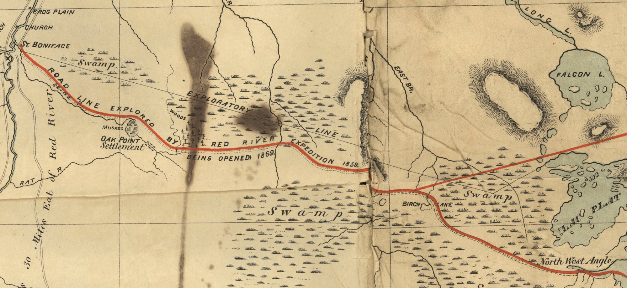
Dawson Road portion of Simon J. Dawson’s Route from Lake Superior to the Red River Settlement as drawn by S.J. Dawson and A.L. Russell (1869). Note Dawson’s notation of his previous 1858 explorations with the Hind Expedition. Retrieved from https://commons.wikimedia.org/wiki/File:Map_Shewing_Line_of_Route_Between_Lake_Superior_and_Red_River_Settlement_(1869).jpg or the original source https://www.flickr.com/photos/manitobamaps/3716493151/#/
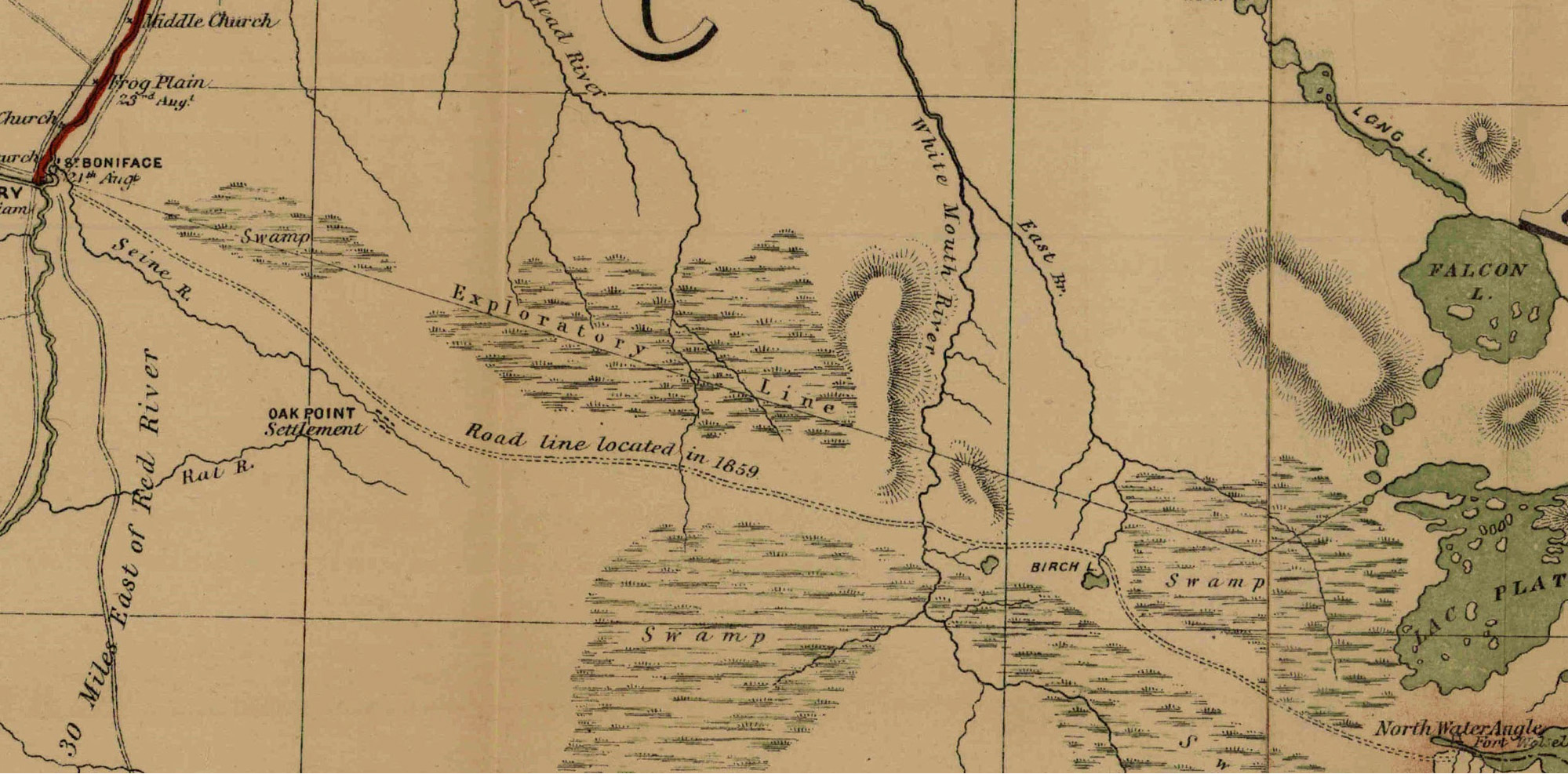
Dawson Road portion of the “Shewing Line of Route” between Lake Superior and Red River Settlement by Simon J. Dawson, as lithographed and printed by Captain C.W. Wilson of the Department of War Office, 1870. The date, as noted on the map itself, refers to the arrival of the first Detachment of the Expeditionary Force led by Wolseley. Retrieved from https://www.flickr.com/photos/manitobamaps/2089382823
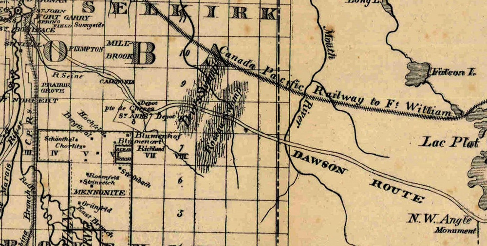
Map of Manitoba 1876, close-up S-E section. Image Courtesy of University of Manitoba. Retrieved from https://www.flickr.com/photos/manitobamaps/2115600381
Prochaine page: Le sentier Dawson aujourd'hui | Haut de page
Page précédente: Coûts estimés de la route Dawson
Page suivante: Le sentier Dawson aujourd'hui